Hammarland
Hammarland | |
|---|---|
Municipality | |
| Hammarlands kommun | |
   _2.jpg) | |
 Coat of arms | |
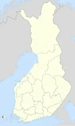 Location of Hammarland in Finland | |
 Hammarland Location in Åland | |
| Coordinates: 60°13′N 019°44′E / 60.217°N 19.733°E | |
| Country | |
| Region | |
| Sub-region | Countryside |
| Government | |
| • Municipal manager | Kurt Carlsson |
| Area (2018-01-01)[1] | |
• Total | 1,224.17 km2 (472.65 sq mi) |
| • Land | 138.55 km2 (53.49 sq mi) |
| • Water | 1,084.84 km2 (418.86 sq mi) |
| • Rank | 285th largest in Finland |
| Population (2025-06-30)[2] | |
• Total | 1,640 |
| • Rank | 276th largest in Finland |
| • Density | 11.84/km2 (30.7/sq mi) |
| Population by native language | |
| • Swedish | 89.9% (official) |
| • Finnish | 3.3% |
| • Others | 6.8% |
| Population by age | |
| • 0 to 14 | 17.7% |
| • 15 to 64 | 60.2% |
| • 65 or older | 22.1% |
| Time zone | UTC+02:00 (EET) |
| • Summer (DST) | UTC+03:00 (EEST) |
| Website | www |
Hammarland is a municipality of Åland, an autonomous region of Finland. Its entire population of 1,640 people (30 June 2025) speak Swedish, with 90% having it as their first language (31 December 2008). Hammarland is known for its historic church, considered one of the mother churches of Åland.
Geography
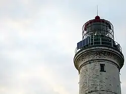
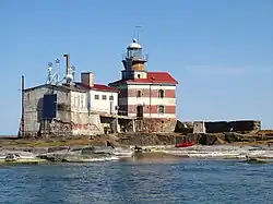
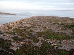
Hammarland has a total area of 1,224.17 square kilometres (472.65 sq mi), of which 1,084.84 km2 (418.86 sq mi) is water and only 138.55 square kilometres (53.49 sq mi) is land.[1] Märket, the westernmost point of Finland, is an exclave of Hammarland.[5]
Demographics
The municipality has a population of 1,640 (30 June 2025), with a population density of 11.84 inhabitants per square kilometre (30.7/sq mi).[2]
The municipality is unilingually Swedish. As of 31 December 2008, 90% of its population spoke Swedish as their first language, making Hammarland one of the municipalities with the highest percentage of Swedish speakers in Finland.[6]
Church
The Hammarland Church is a historic building located on an old postal road in the municipality's north, near a small lake connected to a bay and the sea. It is consecrated to Saint Catherine of Alexandria and is considered one of the mother churches of Åland.[7]
Constructed from local red granite, known as rapakivi, the church features a stepped skyline composed of three distinct levels.[7] The highest point is a pyramidal tower built against the western section of the nave's southern wall. The nave itself forms the second-highest structure, while the lowest part is a narrowing chancel to the east, constructed against the nave's original eastern wall.[7] There are small stones in the nave, with larger granite slabs framing the corners. A simple stepped socle runs along the base of the nave, except for a short stretch on the southern side. The church is characterised by large, roughly hewn windows, and the south façade of the nave shows clear evidence of later modifications.[7]
Transportation
The main road of Hammarland is Highway 1 between Mariehamn and Eckerö.[8]
References
- ^ a b "Area of Finnish Municipalities 1.1.2018" (PDF). National Land Survey of Finland. Retrieved 30 January 2018.
- ^ a b c "Population increased most in Uusimaa in January to June 2025". Population structure. Statistics Finland. 24 July 2025. ISSN 1797-5395. Retrieved 24 July 2025.
- ^ "Population according to age (1-year) and sex by area and the regional division of each statistical reference year, 2003–2020". StatFin. Statistics Finland. Retrieved 2 May 2021.
- ^ a b "Luettelo kuntien ja seurakuntien tuloveroprosenteista vuonna 2023". Tax Administration of Finland. 14 November 2022. Retrieved 7 May 2023.
- ^ "Citizen's Map Site – National Land Survey of Finland". Archived from the original on 11 January 2016. Retrieved 29 May 2025.
- ^ "Population according to language and the number of foreigners and land area km2 by area as of 31 December 2008". Statistics Finland's PX-Web databases. Statistics Finland. Archived from the original on 12 June 2009. Retrieved 29 March 2009.
- ^ a b c d "Hammarland Church". Kyrkor.ax. Retrieved 29 May 2025.
- ^ "Jomala Kommun – Kommunöversikt" [Jomala Municipality – Municipality Overview] (PDF) (in Swedish). Jomala Municipality. Retrieved 29 May 2025.
External links
 Media related to Hammarland at Wikimedia Commons
- Official website
Places adjacent to Hammarland | ||||||||||||||||
|---|---|---|---|---|---|---|---|---|---|---|---|---|---|---|---|---|
| ||||||||||||||||