Gorasara
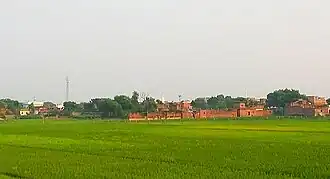
Gorasara
chota Kashmir | |
|---|---|
village | |
 | |
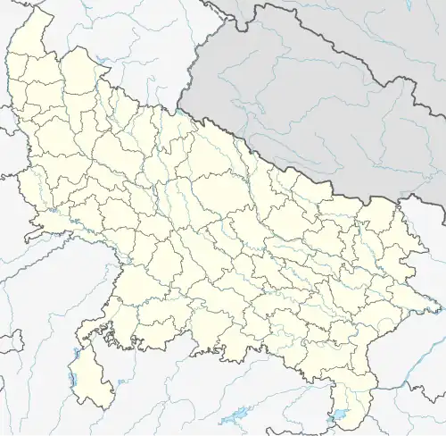 Gorasara Location in Uttar Pradesh, India  Gorasara Gorasara (India) | |
| Coordinates: 25°26′N 83°44′E / 25.43°N 83.74°E | |
| Country | |
| State | |
| Division | Varanasi |
| District | Ghazipur |
| Established | 1655 |
| Founded by | Zamindar Bhikham Khan alias Feqan Khan |
| Government | |
| • Body | Gram panchayat |
| Area | |
• Total | 397.96 ha (983.38 acres) |
| • Land | 380.227 ha (939.561 acres) |
| • Water | 17.733 ha (43.819 acres) |
| Population (2011) | |
• Total | 4,684 |
| • Density | 1,200/km2 (3,000/sq mi) |
| Demonym | Kamsari |
| Language | |
| • Official | Hindi[1] |
| • Additional official | Urdu[1] |
| Time zone | UTC+5:30 (IST) |
| PIN | 232333 |
| Telephone code | +91-0548 |
| Vehicle registration | up-61 |
| Nearest city | Dildarnagar |
| Sex ratio | 1000/937 ♂/♀ |
| Lok Sabha constituency | Ghazipur |
| Vidhan Sabha constituency | Zamania |
| Website | up |
Gorasara is a village located in Dildarnagar Kamsar, Uttar Pradesh, India.[2] Gorasara village was established by Bhikham Khan, son of Fateh Bahadur Khan, and great great grand son of Narhar Khan.[3]
As of the 2011 Census of India[4], the main population of the village lived in an area of 87.5 acres of land with 637 households.[5][6][7]
History
Gorasara is a village located in Dildarnagar Kamsar, Uttar Pradesh, India.[2] Gorasara village was established by Bhikham Khan, son of Fateh Bahadur Khan, and great great grand son of Narhar Khan.[8]
The place was of Kamsaar estate, actually Kamsar jagir already existed during the time of Narhar Khan founder of Kamsar and revenue was paid to Sur empire. But later during Mughals it was reestablished by Raja Quttul Khan a jagirdar of the pargana and Sarkar, and the divan of the subah, he build a fort here in early 1600s and dug a canal around it for sequrity, during the time of later years of Akbar's rule. Still some parts of the canal can be seen around the village
During his time, Kamsaar jagir's main administrative centre was Seorai and Kuttul Khan was its governor. Kamsaar jagir was spread over 52 nearby villages granted by Akbar. He also build a fort and a Mosque, and Eidgah in the village of Seorai. Although he was killed in a dispute by Man Singh Rai of Reotipur, then his cousin Daud Khan of Dewaitha, took revenge of his death and succeeded him. During the 1860s a large number of people belonging to Kushwaha families settled in the village. The name Seorai was kept because there was also a large population of Sevri families who had settled here during the time of Babur. After the death of Quttul Khan one of his grand sons name as Zamindar Fulan Khan settled here with his family in year 1630. While seorai was established as a taluka of Kamsaar, Reotipur, Sherpur region. Which were large villages, among the 52 villages taluka. The Sakarwars of Seorai, settled here from the family of Shubhsen Rao, who was a great-grandson of Raja Dham Dev Rao of Gahmar. Where as the Kamsaries were from Fulan Khan a grandson of Quttul Khan. Fulan Khan's family lived here for many years. But, the population of Zamindar Fulan Khan family decreased and most of them migrated to & Mania
Gorasara, located in the Zamania pargana of Ghazipur, witnessed a tragic historical event during the reign of Mughal Emperor Shah Alam I. On 16th Muharram (Tuesday, 1710-11 CE), Kunwar Dheer Singh (Muhammad Bahrmand Khan), the faujdar of Chainpur and the son of zamindar Muhammad Deendar Khan of Dildarnagar, was martyred while defending the region against a rebellious former faujdar of Chausa. The attack was orchestrated due to animosity from Moatsim Khan, the faujdar of Ghazipur.
The rebels looted villages like Seorai, Bareji, , and Maniya, destroying property and desecrating Seorai's old mosque. Bahrmand Khan and his companions, including Sheikh Dayanatullah, Muhammad Hamza, and Muhammad Sultan, sacrificed their lives to protect the region.
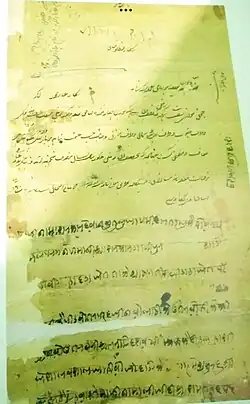
The event deeply grieved Muhammad Dindar Khan, who documented the incident in a Persian "Mahzarnama" addressed to the emperor. Today, the Deendar Shamsi Museum and Library preserves this document, along with the legacy of Bahrmand Khan's bravery, as reflected in the five graves at Seorai's Kuttul Khan Mosque.[9][10][11]
Agriculture
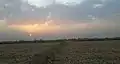
The soil of the village is rich in minerals.[12] The water level of the village is less than 100 feet deep. The village land extends to the banks of Karmansa River. As of the 2011 census, the area of the village is 983.38 acres. ponds cover 18 acres, with the rest of the land dedicated to other crop production. Many types of crops that grow in the nearby Ghazipur and Buxar districts are grown in the village.[13]
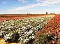
Gorasara has been known for its sunflower farming for more than 300 years. During the summer, sunflowers are planted on a large scale in the village, usually on more than 500 acres of land. Flowers are sent to other cities, states and countries. Sunflowers were used to make sunflower oil in the village during the Mughal and British eras. Rose farming is also done on a large scale. The village is known for its rose plantation done every year to make rose water. Every year different breeds of sunflower and rose are planted on a large scale in the village.[14]
Plantation
When Goarasar village was established by Bhikham Khan (a descendant of Narhar Khan of Kamsar), his son Fateh Bahadur Khan build a large orchard in the village which was named Hazara Bagh. The orchard built by Fateh took over an area of hundreds of bigha and thousands of trees. Now the orchard is owned by his descendants who are Kamsar Pathans.[14]
Historical population
| Year | Pop. | ±% |
|---|---|---|
| 1861 | 1,205 | — |
| 1871 | 1,446 | +20.0% |
| 1881 | 1,807 | +25.0% |
| 1891 | 2,170 | +20.1% |
| 1901 | 2,495 | +15.0% |
| 1911 | 2,994 | +20.0% |
| 1921 | 3,743 | +25.0% |
| 1931 | 4,117 | +10.0% |
| 1941 | 4,325 | +5.1% |
| 1951 | 4,303 | −0.5% |
| 1961 | 4,098 | −4.8% |
| 1971 | 3,884 | −5.2% |
| 1981 | 4,200 | +8.1% |
| 1991 | 4,372 | +4.1% |
| 2001 | 4,500 | +2.9% |
| 2011 | 4,684 | +4.1% |
| Source:Census of India[15][16][17] | ||
Gallery

References
- ^ a b "52nd Report of the Commissioner for Linguistic Minorities in India" (PDF). nclm.nic.in. Ministry of Minority Affairs. Archived from the original (PDF) on 25 May 2017. Retrieved 26 December 2018.
- ^ a b "Bhulekh".
- ^ Ansari, Saiyad Hasan (1986). "Evolution and Spatial organisation of clan settlements in middle ganga valley".
- ^ "Panchyati Raj, Ghazipur". Archived from the original on 28 December 2019.
- ^ "2011 Census of India".
- ^ Oldham, Wilton (1870). Historical and Statistical Memoir of the Ghazeepoor District. Government Press, North-Western Provinces.
- ^ accuweather 2025 for Dildarnagar
- ^ Ansari, Saiyad Hasan (1986). "Evolution and Spatial organisation of clan settlements in middle ganga valley".
- ^ Ansari, Saiyad Hasan (1986). Evolution and Spatial Organization of Clan Settlements: A Case Study of Middle Ganga Valley. Concept Publishing Company.
- ^ "Ghazipur: A Gazetteer being Vol. XXIX of the District Gazetteers of the United Provinces of Agra and Oudh". 1 December 2022. Archived from the original on 1 December 2022. Retrieved 22 December 2024.
- ^ Infotech, Sysmarche. "Khabre Aaj Bhi मौज़ा सेवराई बचाने में हो गये थे सात लोग शहीद". khabreaajbhi.com. Retrieved 24 December 2024.
- ^ http://lsi.gov.in:8081/jspui/bitstream/123456789/893/1/20460_1951_GHA.pdf
- ^ Ansari, Saiyad Hasan (1986). "Evolution and Spatial organisation of clan settlements in middle ganga valley".
- ^ a b Nevill, H. R. (13 January 2024). "Ghazipur Gazatteer".
- ^ "Census of India". mospi.gov.in. Archived from the original on 13 August 2008. Retrieved 23 June 2008.
- ^ "2011 census of India".
- ^ "Historical Census of India". Archived from the original on 17 February 2013. Retrieved 5 November 2015.