Georgetown, McDonough County, Illinois
Georgetown, Illinois | |
|---|---|
 Georgetown  Georgetown | |
| Coordinates: 40°27′40″N 90°43′05″W / 40.46111°N 90.71806°W | |
| Country | United States |
| State | Illinois |
| County | McDonough |
| Township | Emmet |
| Area | |
• Total | 0.144 sq mi (0.37 km2) |
| • Land | 0.144 sq mi (0.37 km2) |
| • Water | 0 sq mi (0 km2) |
| Elevation | 600 ft (200 m) |
| Population | |
• Total | 368 |
| • Density | 2,600/sq mi (990/km2) |
| Time zone | UTC-6 (Central (CST)) |
| • Summer (DST) | UTC-5 (CDT) |
| ZIP Code | 61455 (Macomb) |
| Area code | 309 |
| GNIS feature ID | 2633173[2] |
Georgetown is an unincorporated community and census-designated place (CDP) in McDonough County, Illinois, United States. Its population was 368 as of the 2020 census.[3]
The community is in central McDonough County, on the western border of the city of Macomb, the McDonough county seat. According to the U.S. Census Bureau, the Georgetown CDP has an area of 0.14 square miles (0.36 km2), all land.[1] The community is in the valley of the East Fork of the La Moine River.
Georgetown is part of Macomb Community Unit School District 185[4], and high schoolers go to Macomb High School.
References
- ^ a b "2022 U.S. Gazetteer Files: Illinois". United States Census Bureau. Retrieved March 6, 2023.
- ^ a b U.S. Geological Survey Geographic Names Information System: Georgetown, McDonough County, Illinois
- ^ a b "P1. Race – Georgetown CDP, Illinois: 2020 DEC Redistricting Data (PL 94-171)". U.S. Census Bureau. Retrieved March 6, 2023.
- ^ "Illinois Report Card". www.illinoisreportcard.com. Retrieved August 16, 2025.
Municipalities and communities of McDonough County, Illinois, United States | ||
|---|---|---|
| Cities | 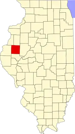 | |
| Villages | ||
| Townships | ||
| CDPs | ||
| Other communities | ||
| Ghost town | ||
| Footnotes | ‡This populated place also has portions in an adjacent county or counties | |