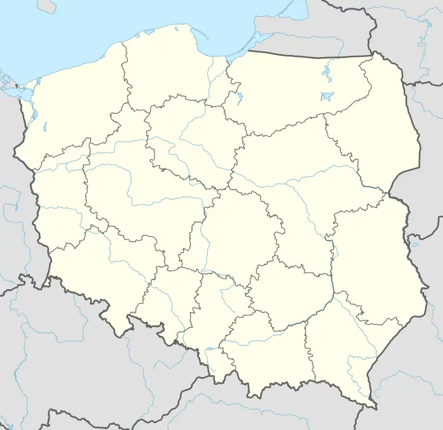
Głowaczewo, Kołobrzeg County
Głowaczewo | |
|---|---|
Village | |
.JPG) | |
 Głowaczewo | |
| Coordinates: 54°7′57″N 15°26′15″E / 54.13250°N 15.43750°E | |
| Country | |
| Voivodeship | West Pomeranian |
| County | Kołobrzeg |
| Gmina | Kołobrzeg |
| Population | |
• Total | 90 |
| Time zone | UTC+1 (CET) |
| • Summer (DST) | UTC+2 (CEST) |
| Vehicle registration | ZKL |
Głowaczewo [ɡwɔvaˈt͡ʂɛvɔ] (German: Papenhagen)[1] is a village in the administrative district of Gmina Kołobrzeg, within Kołobrzeg County, West Pomeranian Voivodeship, in north-western Poland.[2] It lies approximately 10 km (6 mi) south-west of Kołobrzeg and 98 km (61 mi) north-east of the regional capital Szczecin.
The village has a population of 90.
History
The area became part of the emerging Polish state under its first ruler Mieszko I around 967,[3] and following Poland's fragmentation it formed part of the Duchy of Pomerania. The suffix -hagen of the former village name is typical for settlements founded by German immigrants during Medieval Ostsiedlung.[4]
During World War II, the German administration operated a forced labour subcamp of the Stalag II-D prisoner-of-war camp in the village.[5]
See also
References
- ^ M. Kaemmerer (2004). Ortsnamenverzeichnis der Ortschaften jenseits von Oder u. Neiße (in German). ISBN 3-7921-0368-0.
- ^ "Główny Urząd Statystyczny" [Central Statistical Office] (in Polish). To search: Select "Miejscowości (SIMC)" tab, select "fragment (min. 3 znaki)" (minimum 3 characters), enter town name in the field below, click "WYSZUKAJ" (Search).
- ^ Labuda, Gerard (1993). "Chrystianizacja Pomorza (X–XIII stulecie)". Studia Gdańskie (in Polish). Vol. IX. Gdańsk-Oliwa. p. 47.
- ^ Adolf Bach (1954). Die deutschen Ortsnamen. Deutsche Namenkunde. Vol. II, 2. Heidelberg. p. 204.
{{cite book}}: CS1 maint: location missing publisher (link) - ^ "Work Camps". Retrieved 13 June 2025.
| Seat (not part of the gmina) |  | |
|---|---|---|
| Villages | ||