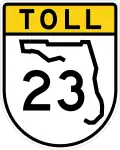
Florida State Road 23
 State Road 23 | ||||
|---|---|---|---|---|
| First Coast Expressway | ||||
Completed section of SR 23 highlighted in red | ||||
| Route information | ||||
| Maintained by Florida's Turnpike Enterprise | ||||
| Length | 33.6 mi[1] (54.1 km) | |||
| Major junctions | ||||
| South end | ||||
| North end | ||||
| Location | ||||
| Country | United States | |||
| State | Florida | |||
| Counties | Clay, Duval | |||
| Highway system | ||||
| ||||
State Road 23 (SR 23), also known as the First Coast Expressway, is a controlled-access toll road serving as an outer bypass around the southwest quadrant of Jacksonville, Florida. As of 2025, the first and second phases have been built, linking Interstate 10 (I-10) near Whitehouse with US 17 in the Green Cove Springs area.
The ultimate plan is for a 46.5-mile (74.8 km) four-lane controlled-access, electronically-tolled highway between I-10 and I-95. The total investment for the entire highway is estimated at $2 billion. Construction of the final section began in 2024 and is expected to be completed by 2032. It extends from near Green Cove Springs, crosses the St. Johns River, then continues east through fast-growing northern St. Johns County to a point approximately 3.5 miles (5.6 km) north of the World Golf Village interchange along I-95.
Route description
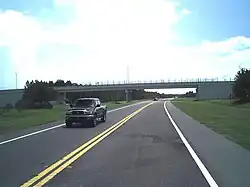
The First Coast Expressway begins at an interchange with US Highway 90 (US 90, Beaver Street). Shortly after, the expressway heads southbound towards a cloverstack interchange with I-10. Following the major interchange, the freeway widens to four lanes and continues south towards interchanges with POW-MIA Memorial Highway and SR 134 (103rd Street), providing access to the nearby Cecil Field. The highway continues through the suburban outskirts of Jacksonville before crossing into Clay County following the interchange with Argyle Forest Boulevard/Oakleaf Plantation Parkway. The expressway follows a pair of frontage roads from the second interchange with Oakleaf Plantation until the half-diamond interchange with Old Jennings Road. The highway continues for roughly a mile (1.6 km), passing by St. Vincent's Hospital, reaching SR 21 (Blanding Boulevard) near Middleburg. The highway curves southeast-east around the Black Creek Ravines Conservation Area and Lake Asbury, crossing over Black Creek before reaching a diverging diamond interchange with CR 739. There, the highway curves south again. Continuing south, the highway has another diverging diamond interchange with Cathedral Oak Parkway, and turning southeast, has another diverging diamond interchange with SR 16 west of Green Cove Springs. The highway continues southeast before curving northeast before reaching its current southern terminus at US 17 south of Green Cove Springs.
History
| External videos | |
|---|---|
The plans for connecting I-10 to SR 21 (Blanding Blvd) date back to 1979. SR 23 was originally planned as a toll road by Florida's Turnpike Enterprise to meet those plans, but those plans fell through in 1997.
The Jacksonville Transportation Authority and Clay County worked together to connect Branan Field Road in Clay County and Chaffee Road in Duval County. By 2003, the Duval County section was open, and connected south to Branan Field Road in Clay County. By late 2004, the Clay County section was added. On August 9, 2025, the second phase in Clay County opened, extending the route from SR 21 near Middleburg to U.S. Route 17 south of Green Cove Springs.[2]
The project was formerly known as the First Coast Outer Beltway and the Branan Field-Chaffee Expressway, but its current name is the First Coast Expressway.
Future
The partial outer beltway when finished will contain 17 interchanges and a new bridge across the St. Johns River in place of the current two-lane Shands Bridge.[3]
Funding
Funding for the $1.8 billion project will be competitively bid as a public-private partnership (PPP) opportunity for private sector businesses. By using a PPP and innovative contracting solutions, the project will be built years earlier than with traditional contracting methods. The awarded contractor(s) will serve as the concessionaire to design, build, finance, operate and maintain the beltway. The Florida Department of Transportation (FDOT) is currently engaging private contractors in a competitive bidding process. The I-595 Corridor Express PPP with I-595 Express LLC was the first of its kind in Florida, opening years ahead of schedule.[4] The beltway is the one of largest public infrastructure projects to be undertaken in Northeast Florida.
In early 2011, FDOT abandoned the plan to find a private company to build the entire 46.6-mile (75.0 km) beltway and just focus on building the 15 mile section between I-10 and SR 21 (Blanding Boulevard). This section is partly built and would need flyovers built and widening done for the expressway to be complete. It is expected to cost around $291 million and would be a tollway.[5]
In August 2011, FDOT announced that the Florida's Turnpike Enterprise will be taking on the $291 million project of turning the 15-mile (24 km) stretch into a tollway.[6] Construction started on September 10, 2012, and was completed in 2017.
Construction on the second phase of the expressway, from SR 21 (Blanding Boulevard) to Green Cove Springs, started in October 2019 and was completed in August 2025. The third and final phase of the project, which includes replacement of the Shands Bridge, started in May 2023 and will be completed in 2031.[7] Bridge construction will begin in 2024. Construction on the segment between County Road 16A (CR 16A) to St. Johns Parkway (CR 2209) is expected to start in early 2025, and from St. John's Parkway to I-95 in late 2025.
Tolling
All tolls are electronic and compatible with SunPass used in other parts of the state with no toll booths. There is a free section between US 90 and POW-MIA Memorial Parkway which helps promote growth in the Cecil Commerce Center, and the future Shands Bridge crossing the St. Johns River will be free as well.[8]
Exit list
Tolls are collected between each exit south of exit 42.[9]
| County | Location | mi[1] | km | Exit | Destinations | Notes |
|---|---|---|---|---|---|---|
| St. Johns | | 0.0 | 0.0 | 1 | Future interchange and future southern terminus; I-95 future exit 326 | |
| SilverLeaf Plantation | 2.5 | 4.0 | 3 | Future planned interchange | ||
| | 6.9 | 11.1 | 6 | Future planned interchange | ||
| St. Johns River | 9.5 | 15.3 | Shands Bridge | |||
| Clay | | 10.6 | 17.1 | 10 | Future planned partial interchange (northbound exit and southbound entrance) | |
| | 13.0 | 20.9 | 13 | Current southern terminus | ||
| | 20.0 | 32.2 | 20 | Diverging diamond interchange; northbound exit and southbound entrance tolled | ||
| Lake Asbury | 23.0 | 37.0 | 23 | Diverging diamond interchange; northbound exit and southbound entrance tolled | ||
| 24.0 | 38.6 | Sandridge Toll Gantry | ||||
| 27.6 | 44.4 | 28 | Diverging diamond interchange; southbound exit and northbound entrance tolled | |||
| | 30.9 | 49.7 | 31 | |||
| | 32.1 | 51.7 | 32 | Southbound exit and northbound entrance; southern terminus of frontage roads | ||
| | 33.0 | 53.1 | Trail Ridge Toll Gantry | |||
| Oakleaf Plantation | 34.5 | 55.5 | 35 | Oakleaf Plantation Parkway / Discovery Drive | Partial diverging diamond interchange; northern terminus of frontage roads | |
| 35.4 | 57.0 | Plantation Oaks Boulevard | Former at-grade intersection | |||
| 36.0 | 57.9 | Plantation Toll Gantry | ||||
| Duval | Jacksonville | 37.1 | 59.7 | 37 | Argyle Forest Boulevard / Oakleaf Plantation Parkway | Single point urban interchange |
| 38.0 | 61.2 | Argyle Toll Gantry | ||||
| 40.7 | 65.5 | 41 | ||||
| 40.9 | 65.8 | Chaffee Road (CR 115C north) | Southern terminus of CR 115C | |||
| 42.0 | 67.6 | Normandy Toll Gantry | ||||
| 42.1 | 67.8 | 42 | ||||
| 43.0 | 69.2 | POW-MIA Parkway Toll Gantry | ||||
| 43.5 | 70.0 | 44 | POW-MIA Memorial Parkway | |||
| 45.6 | 73.4 | 46 | I-10 exit 350, signed as exits 46A (east) and 46B (west) | |||
| 46.6 | 75.0 | Current northern terminus | ||||
| 1.000 mi = 1.609 km; 1.000 km = 0.621 mi | ||||||
References
- ^ a b FDOT straight line diagrams Archived March 6, 2014, at the Wayback Machine
- ^ Gilliam, Terry (August 10, 2025). "18 miles of First Coast Expressway now open to drivers". First Coast News. Tegna Inc. Retrieved August 15, 2025.
- ^ "First Coast Outer Beltway plan sheets" (PDF). Archived from the original (PDF) on April 7, 2014. Retrieved April 4, 2014.
- ^ "Crist touts outer beltway in Clay County speech". Clay Today. Archived from the original on July 6, 2011. Retrieved March 31, 2010.
- ^ Hannan, Larry (August 15, 2011). "State to make announcement on Outer Beltway". The Florida Times-Union. Archived from the original on January 26, 2013. Retrieved August 15, 2011.
- ^ Hannan, Larry. "Outer Beltway: $2.25 estimated cost to drive from I-10 to Blanding". The Florida Times-Union. Retrieved April 18, 2024.
- ^ "Residents get sneak peek of future Shands Bridge". June 2023.
- ^ "Outer Beltway around Cecil Commerce Center will not be tolled". Florida Times-Union. Jacksonville. Archived from the original on November 9, 2017. Retrieved April 2, 2010.
- ^ "Get ready to pay tolls on First Coast Expressway". June 11, 2019.