Farmingdale, New York
Farmingdale, New York | |
|---|---|
| Incorporated Village of Farmingdale | |
 Main Street in Farmingdale in 2025 | |
 Flag  Seal | |
| Nickname(s): "Farmingdale Village", "The Village" | |
 Location in Nassau County and the state of New York | |
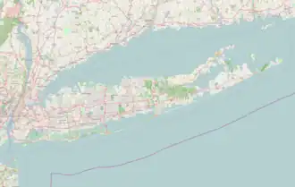 Farmingdale, New York Location on Long Island  Farmingdale, New York Location within the state of New York | |
| Coordinates: 40°44′0″N 73°26′42″W / 40.73333°N 73.44500°W | |
| Country | |
| State | |
| County | Nassau |
| Town | Oyster Bay |
| Incorporated | 1904 |
| Government | |
| • Mayor | Ralph Ekstrand |
| • Deputy Mayor | William Barrett |
| Area | |
• Total | 1.09 sq mi (2.83 km2) |
| • Land | 1.09 sq mi (2.83 km2) |
| • Water | 0.00 sq mi (0.00 km2) |
| Elevation | 69 ft (21 m) |
| Population (2020) | |
• Total | 8,466 |
| • Density | 7,738.57/sq mi (2,987.43/km2) |
| Time zone | UTC−5 (Eastern (EST)) |
| • Summer (DST) | UTC−4 (EDT) |
| ZIP Code | 11735 |
| Area codes | 516, 363 |
| FIPS code | 36-25384 |
| GNIS feature ID | 0949918 |
| Website | www |
Farmingdale is an incorporated village located within the Town of Oyster Bay in Nassau County, on Long Island, New York, United States. It is considered the anchor community of the Greater Farmingdale area. The population was 8,466 at the time of the 2020 census.
The Incorporated Village of Farmingdale is located approximately 37 miles (60 km) to the southeast of Midtown Manhattan.
History
The first European settler in the area was Thomas Powell, who arrived in 1687. On October 18, 1695, he purchased a 15-square-mile (39 km2) tract of land from three Native American tribes. This is known as the Bethpage Purchase and includes what is now Farmingdale – in addition to Bethpage, Melville, North Massapequa, Old Bethpage, Plainedge, and Plainview. One of two houses he erected in the area (built c. 1738) still stands on Merritts Road within Farmingdale.[2]
In the 1830s, anticipating construction of the Long Island Rail Road, land developer Ambrose George purchased a large tract of land between a community then known as Bethpage (now Old Bethpage) and an area in Suffolk County known as Hardscrabble.[3][4] He built a general store in the western part of this property which he named Farmingdale. When the LIRR started service to the area in October 1841,[5][6] it named its new station in the community as Farmingdale, on the line it was building to Greenport. Stagecoaches took people from the Farmingdale station to Islip, Babylon, Patchogue, Oyster Bay South, and West Neck (Huntington area).[7][8]
In 1886 a fire department was organized, and in 1899, Mile-a-Minute Murphy rode a bicycle along the Long Island Rail Road's Central Branch through the Farmingdale area at a mile a minute. For many years, the town celebrated its birth with the annual Hardscrabble Fair, with music, food and games. It was normally held in May.[2]
In 1904, Farmingdale incorporated as a village, after locals voted in favor of doing so through a referendum.[2]
The Lenox Hills Country Club – an 18-hole private golf course designed by Devereux Emmet – was developed north of the community in 1923 and was owned and operated by Benjamin F. Yoakum. This golf course was purchased by the State of New York, was greatly expanded, and then re-opened as Bethpage State Park in 1932, with much of the golf design work carried out by golf architect A.W. Tillinghast, later inducted into the World Golf Hall of Fame.[9][10] The 1920s-built Lenox Hills section and later, adjacent subdivisions – located between the Bethpage State Park golf courses and the Long Island Railroad trackage, encompassing rolling hills and a wide boulevard – are known as the more upscale part of Farmingdale Village.[9][10]
About the time of World War II, the Farmingdale area became a locus for the aircraft industry, notably Republic Aviation Company, which was based at just east of the Village of Farmingdale at Republic Airport, located within the adjacent hamlet of East Farmingdale.[11][12]
Geography
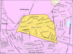
According to the United States Census Bureau, the village has a total area of 1.1 square miles (2.8 km2), all land.[13]
Between the 1990 Census and the 2000 census, the village gained territory.[14]
The Lenox Hills section of the village is adjacent to Bethpage State Park. The rest of the municipality is within a fifteen-minute drive thereto.[12]
Topography and drainage
The Village of Farmingdale is located on a flat outwash plain, and as such, the area's topography is largely flat.[15][16]
Additionally, Farmingdale is split between the Massapequa Creek and Seaford Creek drainage areas, and is located within the larger Long Island Sound/Atlantic Ocean Watershed.[15][16][17]
Climate
According to the Köppen Climate Classification system, Farmingdale has a humid subtropical climate, abbreviated "Cfa" on climate maps. The hottest temperature recorded in Farmingdale was 102 °F (38.9 °C) on July 6, 2010, and July 22, 2011, while the coldest temperature recorded was −1 °F (−18.3 °C) on January 4, 2014.[18]
| Climate data for Farmingdale, New York (Republic Airport), 1991–2020 normals, extremes 1999–present | |||||||||||||
|---|---|---|---|---|---|---|---|---|---|---|---|---|---|
| Month | Jan | Feb | Mar | Apr | May | Jun | Jul | Aug | Sep | Oct | Nov | Dec | Year |
| Record high °F (°C) | 71 (22) |
70 (21) |
82 (28) |
91 (33) |
93 (34) |
96 (36) |
102 (39) |
100 (38) |
94 (34) |
90 (32) |
79 (26) |
69 (21) |
102 (39) |
| Mean maximum °F (°C) | 58.5 (14.7) |
58.0 (14.4) |
67.1 (19.5) |
76.9 (24.9) |
84.9 (29.4) |
89.8 (32.1) |
94.5 (34.7) |
91.3 (32.9) |
87.0 (30.6) |
79.6 (26.4) |
68.5 (20.3) |
61.2 (16.2) |
95.5 (35.3) |
| Mean daily maximum °F (°C) | 38.9 (3.8) |
41.3 (5.2) |
48.1 (8.9) |
58.4 (14.7) |
68.1 (20.1) |
77.2 (25.1) |
82.8 (28.2) |
81.5 (27.5) |
74.8 (23.8) |
63.9 (17.7) |
53.4 (11.9) |
44.2 (6.8) |
61.1 (16.1) |
| Daily mean °F (°C) | 32.0 (0.0) |
33.9 (1.1) |
40.4 (4.7) |
50.2 (10.1) |
59.7 (15.4) |
69.1 (20.6) |
75.3 (24.1) |
74.1 (23.4) |
67.2 (19.6) |
56.1 (13.4) |
45.9 (7.7) |
37.5 (3.1) |
53.4 (11.9) |
| Mean daily minimum °F (°C) | 25.1 (−3.8) |
26.4 (−3.1) |
32.7 (0.4) |
41.9 (5.5) |
51.4 (10.8) |
61.1 (16.2) |
67.8 (19.9) |
66.7 (19.3) |
59.6 (15.3) |
48.3 (9.1) |
38.4 (3.6) |
30.8 (−0.7) |
45.8 (7.7) |
| Mean minimum °F (°C) | 8.1 (−13.3) |
11.3 (−11.5) |
19.5 (−6.9) |
30.8 (−0.7) |
41.2 (5.1) |
50.7 (10.4) |
60.6 (15.9) |
58.3 (14.6) |
48.3 (9.1) |
34.9 (1.6) |
25.0 (−3.9) |
18.7 (−7.4) |
6.8 (−14.0) |
| Record low °F (°C) | −1 (−18) |
2 (−17) |
9 (−13) |
24 (−4) |
34 (1) |
46 (8) |
53 (12) |
53 (12) |
41 (5) |
31 (−1) |
14 (−10) |
8 (−13) |
−1 (−18) |
| Average precipitation inches (mm) | 2.69 (68) |
2.03 (52) |
3.46 (88) |
3.61 (92) |
3.18 (81) |
3.45 (88) |
3.05 (77) |
3.25 (83) |
3.66 (93) |
3.37 (86) |
2.93 (74) |
3.60 (91) |
38.28 (973) |
| Average precipitation days (≥ 0.01 in) | 9.3 | 8.7 | 9.9 | 11.2 | 12.6 | 10.9 | 9.9 | 9.6 | 8.1 | 9.9 | 9.2 | 10.7 | 120.0 |
| Source 1: NOAA (mean maxima/minima 2006–2020)[19] | |||||||||||||
| Source 2: National Weather Service[18] | |||||||||||||
Greater Farmingdale area
Farmingdale is also associated with several unincorporated areas outside the village limits, including South Farmingdale (also in the Town of Oyster Bay), and East Farmingdale (in the Town of Babylon, within Suffolk County). Many nearby places not within the village limits have Farmingdale as their postal address and the same 11735 ZIP code. Residents of East Farmingdale must use Farmingdale as their mailing address, while residents of South Farmingdale can use either Farmingdale or South Farmingdale. Bethpage State Park, which is mostly in Old Bethpage, also has a Farmingdale mailing address. Farmingdale Union Free School District (UFSD 22) includes parts of both Nassau County and Suffolk County and the southernmost part of Bethpage State Park, where the clubhouse is located. A road sign on Main Street in the south-east section of South Farmingdale (and over 1 mile (1.6 km) from the Village of Farmingdale) welcomes travelers to Farmingdale. Farmingdale is also the name of the local Farmingdale Water District and Farmingdale Fire District, both of which also include areas outside the boundaries of the Village of Farmingdale. Farmingdale State College and Republic Airport are in East Farmingdale, both with Farmingdale mailing addresses.[2]
Demographics
| Census | Pop. | Note | %± |
|---|---|---|---|
| 1880 | 524 | — | |
| 1910 | 1,567 | — | |
| 1920 | 2,091 | 33.4% | |
| 1930 | 3,373 | 61.3% | |
| 1940 | 3,524 | 4.5% | |
| 1950 | 4,492 | 27.5% | |
| 1960 | 6,128 | 36.4% | |
| 1970 | 9,297 | 51.7% | |
| 1980 | 7,946 | −14.5% | |
| 1990 | 8,022 | 1.0% | |
| 2000 | 8,399 | 4.7% | |
| 2010 | 8,189 | −2.5% | |
| 2020 | 8,466 | 3.4% | |
| U.S. Decennial Census[20] | |||
2010 Census
As of the 2010 census[21] The population of the village was 88.2% White, 71.1% Non-Hispanic White, 2.6% African American, 0.4% Native American, 2.5% Asian, 0.0% Pacific Islander, 4.7% from other races, and 1.7% from two or more races. Hispanic or Latino of any race were 13.7% of the population.
2000 Census
At the 2000 census there were 8,399 people, 3,216 households, and 2,051 families in the village. The population density was 7,432.2 inhabitants per square mile (2,869.6/km2). There were 3,289 housing units at an average density of 2,910.4 per square mile (1,123.7/km2). The racial makup of the village was 87.03% White, 1.61% African American, 0.12% Native American, 3.70% Asian, 0.05% Pacific Islander, 5.06% from other races, and 2.43% from two or more races. Hispanic or Latino of any race were 12.57%.[22]
Of the 3,216 households 28.3% had children under the age of 18 living with them, 50.2% were married couples living together, 9.5% had a female householder with no husband present, and 36.2% were non-families. 29.8% of households were one person and 11.5% were one person aged 65 or older. The average household size was 2.55 and the average family size was 3.19.
The age distribution was 21.2% under the age of 18, 7.3% from 18 to 24, 35.2% from 25 to 44, 21.6% from 45 to 64, and 14.7% 65 or older. The median age was 38 years. For every 100 females, there were 95.2 males. For every 100 females age 18 and over, there were 92.5 males.
The median household income was $58,411 and the median family income was $68,235. Males had a median income of $46,104 versus $36,021 for females. The per capita income for the village was $27,492. About 3.0% of families and 5.6% of the population were below the poverty line, including 3.5% of those under age 18 and 13.0% of those age 65 or over.
Government
Village government

As of July 2023, the Mayor of Farmingdale is Ralph Ekstrand, the Deputy Mayor is William Barrett, and the Village Trustees are Cheryl Parisi, Walter Priestley, and Craig Rosasco.[23][24]
Representation in higher government
County representation
The Village of Farmingdale is located entirely within Nassau County's 17th Legislative district, which as of July 2025 is represented in the Nassau County Legislature by Rose Marie Walker (D–Hicksville).[12][25][26]
State representation
New York State Assembly
Farmingdale is located within New York's 15th State Assembly district, which as of July 2025 is represented by Jacob Ryan Blumencranz (R–Oyster Bay).[12][25][27]
New York State Senate
Farmingdale is located entirely within New York's 5th State Senate district, which as of July 2025 is represented by Steven Rhoads (R–Bellmore).[12][25][28]
Federal representation
United States Congress
Farmingdale is located entirely within New York's 3rd Congressional district, which as of July 2025 is represented in the United States Congress by Thomas R. Suozzi (D–Glen Cove).[12][25][29]
United States Senate
As with the rest of New York, Farmingdale is represented in the United States Senate by Kirsten E. Gillibrand (D) and Charles E. Schumer (D).[30][31]
Politics
In the 2024 U.S. presidential election, the majority of Farmingdale voters voted for Donald J. Trump (R).[32]
Education
Schools
Farmingdale is served by the Farmingdale Union Free School District.[12] The district includes Farmingdale High School, Howitt Middle School, Northside Elementary School, Woodward Parkway School, Albany Avenue Elementary School, and Saltzman East Memorial.[12]
Furthermore, the Northside Elementary School and Howitt Middle School are both located within the village.[12]
Library district
Farmingdale is located within the boundaries of the Farmingdale Library District, which is served by the Farmingdale Public Library.[12]
Infrastructure
Transportation
Road

Two state roads are pass through (and thus directly serve) the Village of Farmingdale:[12][25]
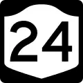 Conklin Street (NY 24) – Runs through the heart of Farmingdale and its downtown, from west-to-east.[12][25]
 Fulton Street (NY 109) – Runs along northwest-to-southeast through the southern portion of the village; roughly parallels the Long Island Rail Road's Central Branch.[12][25]
Other major roads within the village include Bethpage Road, Clinton Street, Front Street, Main Street, Melville Road, Merritts Road, Secatogue Avenue, Staples Road, and Thomas Powell Boulevard.[12][25]
Rail
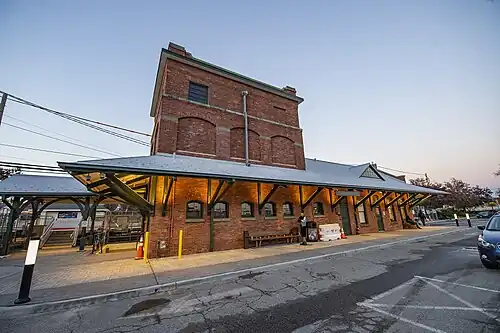
The Long Island Rail Road's Farmingdale station – a major station on the LIRR's Main Line, serving Ronkonkoma Branch trains – is located within the village's downtown area.[12][25] Additionally, the LIRR's Central Branch forms much of the village's southern border – although it makes no stops within Farmingdale.[12][25]
The village is also the site of a transit-oriented development centered around the LIRR station.[12]
Bus
The Village of Farmingdale is served by two Nassau Inter-County Express (NICE) routes: the n70 and n71.[12][33]
Greenway
A Long Island Greenway is planned from Farmingdale to Montauk.[34]
Utilities
Natural gas
National Grid USA provides natural gas to homes and businesses that are hooked up to natural gas lines in Farmingdale.[35][36]
Power
PSEG Long Island provides power to all homes and businesses within Farmingdale.[35][37][38]
Sewage
Farmingdale is located within the Nassau County Sewage District and is connected to its sanitary sewer network.[12][39]
Water
The Village of Farmingdale operates its own municipal water supply system, which provides the entirety of the village with water.[12]
Emergency services
Fire
The Village of Farmingdale features its own fire department, which provides the entire village with fire protection.[12]
Police
Farmingdale is served by the Nassau County Police Department's 8th Precinct.[12][40][41][42]
Notable people
- Barbara Stern Burstin, Holocaust scholar
- Gregory W. Carman, (1937–2020) US Congressman
- Ryan Cruthers, professional hockey player[43]
- Canute Curtis, former American college (West Virginia) and professional football (Cincinnati Bengals) player
- Matt Danowski, professional lacrosse player[44]
- Dan Domenech, theater actor[45]
- William Gaddis, U.S. novelist
- Peter J. Ganci Jr. (1946–2001), Chief of Department of the New York City Fire Department; murdered in the September 11 terrorist attacks[46]
- George Hincapie, professional bicycle racer[47]
- Howard T. Hogan, New York State Supreme Court Justice
- Ze'ev Jabotinsky, leader of "Revisionist" Zionism; was buried in the New Montefiore Cemetery until reburial in Jerusalem in 1964
- Tom Kennedy, professional football player for the Detroit Lions[48]
- Ed Kranepool, baseball player, lived in South Farmingdale for many years
- April Lawton, musician and artist, member of Ramatam
- Macseal, indie rock band[49]
- SallyAnn Salsano, producer of MTV reality shows, including Jersey Shore, through her company 495 Productions (named for the interstate passing by the community)
- William T. Schwendler (1904–1978), executive vice president and chairman of the board, Grumman Corporation
- George F. Titterton (1904–1998), senior vice president, Grumman Corporation
- Al Weis, baseball player
See also
References
- ^ "ArcGIS REST Services Directory". United States Census Bureau. Retrieved September 20, 2022.
- ^ a b c d Winsche, Richard (October 1, 1999). The History of Nassau County Community Place-Names. Interlaken, New York: Empire State Books. ISBN 978-1557871541.
- ^
W.W. Mather, geologist of the First District of New York, from the topographical surveys of J. Calvin Smith (c. 1842). "Geological map of Long & Staten islands with the environs of New York". New York Public Library.
{{cite web}}: CS1 maint: multiple names: authors list (link) (The location marked Bethpage is near Merritts Road, just north of the Bethpage Turnpike. An unbounded area further east in Suffolk County is marked Hardscrabble. The map is dated 1842 with a question mark. Neither Farmingdale nor Hicksville appears on the map. The Hicksville LIRR station opened in 1837, and its absence suggests an earlier date for the map. The LIRR also had taken a different route east of Hicksville, arriving in Farmingdale in 1841.) - ^ Eddy, John Henry (1839). "Map of the country thirty miles round the city of New York". Disturnell, John; NY Public Library. 434634. (The location marked Bethpage extends into Suffolk County. This is in accord with maps of the Bethpage Purchase of 1695. This map shows Hicksville, where the LIRR had a station in 1837, but the planned route east of there was changed.)
- ^ "The Long Delay at Hicksville". Newsday. Archived from the original on February 16, 2007.
- ^ "Brooklyn Eagle v1, #1 (LIRR timetable)". Brooklyn Eagle. October 26, 1841. Archived from the original on June 12, 2011. Retrieved April 10, 2008. (Whether "late Bethpage" is meant to indicate a flag stop at the community near Merritts Road, or that the area near the Farmingdale LIRR station had lately been called Bethpage has not yet been determined.)
- ^ David Roberts. "Nassau County Post Offices 1794-1879". Retrieved April 7, 2008. John L. Kay; Chester M. Smith Jr. (1982). New York Postal History: The Post Offices & First Postmasters from 1775 to 1980. American Philatelic Society.
- ^ "1857 Map of Long Island". Library of Congress. 1857. (Hardscrabble again appears in Suffolk County. Several maps in the 1840s mistakenly showed Farmingdale where Hardscrabble is on this map.)
- ^ a b Korsavidis, Natalie. "LibGuides: Farmingdale History Encyclopedia: Y". farmingdalelibrary.libguides.com. Retrieved July 31, 2025.
- ^ a b "Lenox Hills Park Homes, Melville Road And Sherman Road". The New York real estate brochure collection. Retrieved July 31, 2025.
- ^ "WORLD WAR II". William G. Pomeroy Foundation. December 19, 2018. Retrieved July 31, 2025.
- ^ a b c d e f g h i j k l m n o p q r s t u v "Long Island Zoning Atlas". www.longislandindexmaps.org. Retrieved July 16, 2023.
- ^ "US Gazetteer files: 2010, 2000, and 1990". United States Census Bureau. February 12, 2011. Retrieved April 23, 2011.
- ^ "New York: 2000 Population and Housing Unit Counts" (PDF). September 2003. p. III-9. Retrieved December 22, 2010.
- ^ a b New York Rapid Watershed Assessment Profile – Northern Long Island Watershed. Syracuse, New York: United States Department of Agriculture Natural Resources Conservation Service. 2011.
- ^ a b "EPA – Waters GeoViewer". United States Environmental Protection Agency. Retrieved July 31, 2025.
- ^ "Atlantic Ocean/Long Island Sound Watershed - NYS Dept. of Environmental Conservation". www.dec.ny.gov. Retrieved July 31, 2025.
- ^ a b "NOAA Online Weather Data – NWS New York". National Weather Service. Retrieved February 17, 2023.
- ^ "U.S. Climate Normals Quick Access – Station: Farmingdale AP, NY". National Oceanic and Atmospheric Administration. Retrieved February 17, 2023.
- ^ "Census of Population and Housing". Census.gov. Retrieved June 4, 2015.
- ^ "American FactFinder - Results". factfinder2.census.gov. United States Census Bureau. Archived from the original on February 12, 2020. Retrieved April 6, 2018.
- ^ "U.S. Census website". United States Census Bureau. Retrieved January 31, 2008.
- ^ "Inc. Village of Farmingdale". www.farmingdalevillage.com. Retrieved July 16, 2023.
- ^ "Inc. Village of Farmingdale". www.farmingdalevillage.com. Retrieved April 6, 2018.
- ^ a b c d e f g h i j Tomanelli, John (December 19, 2019). "Boundaries Map". Newsday. Retrieved July 9, 2023.
- ^ "District 17 - Rose Marie Walker | Nassau County, NY - Official Website". www.nassaucountyny.gov. Retrieved July 31, 2025.
- ^ "Jake Blumencranz – Assembly District 15 |Assembly Member Directory | New York State Assembly". nyassembly.gov. Retrieved July 9, 2023.
- ^ "About Steven D. Rhoads | NYSenate.gov". www.nysenate.gov. Retrieved December 4, 2024.
- ^ Fandos, Nicholas (February 29, 2024). "Tom Suozzi Returns to Congress With 2 Words for House: 'Wake Up'". The New York Times. ISSN 0362-4331. Retrieved March 1, 2024.
- ^ Sheridan, Johan (September 3, 2020). "Gillibrand and Schumer announce $5M+ for firefighters". NEWS10 ABC. Retrieved December 18, 2020.
- ^ "U.S. Senate: Senators of the 116th Congress". www.senate.gov. Retrieved December 18, 2020.
- ^ LaRocco, Paul (November 12, 2024). "Map: How Long Island voted for president in Harris-Trump race". Newsday. Retrieved November 12, 2024.
- ^ "Nassau Inter-County Express - Maps and Schedules". nicebus.com. Retrieved July 31, 2025.
- ^ "Long Island Greenway - Our Work in NY". Trust for Public Land. Retrieved July 16, 2023.
- ^ a b "Long Island Utility Information - LIPA, Nat Grid, & Local Water Authorities". LongIsland.com. Retrieved October 24, 2020.
- ^ "Natural Gas & Electricity | National Grid". www.nationalgridus.com. Retrieved July 21, 2021.
- ^ "Home Page - PSEG Long Island". www.psegliny.com. Retrieved July 21, 2021.
- ^ "NYS Electric Utility Service Territories Map | State of New York". data.ny.gov. Retrieved July 29, 2025.
- ^ "Sewerage Map – Nassau County". County of Nassau, New York. Retrieved August 5, 2021.
- ^ "County Map | Nassau County Police, NY". pdcn.org. Retrieved October 24, 2020.
- ^ "Police Departments". nassaucountyny.gov. Retrieved December 20, 2020.
- ^ "Quarterly Community Policing Report". www.pdcn.org. October 2016.
- ^ Holland, Monica (July 18, 2023). "SPHL's Fayetteville Marksmen introduce coach Ryan Cruthers. Here's what you need to know". The Fayetteville Observer. Retrieved April 3, 2024.
- ^ S. I. Staff (April 30, 2008). "Redemption in Durham: Two years after the scandal, Duke lacrosse is back on top". Sports Illustrated. Retrieved April 3, 2024.
- ^ Oliveros, Oliver (June 27, 2013). "BWW Interviews: Dan Domenech Talks Becoming TARZAN". BroadwayWorld.com. Retrieved April 3, 2024.
- ^ Atkins, Stephen E. (June 2, 2011). The 9/11 Encyclopedia (2 ed.). ABC-CLIO. p. 203. ISBN 9781598849219. Archived from the original on August 2, 2022. Retrieved August 2, 2022 – via Google Books.
- ^ P. E. Z. Crew (July 2, 2003). "George Hincapie: Pez-Clusive Interview". PezCycling News. Retrieved April 3, 2024.
- ^ Levinsky, Greg (June 9, 2019). "Detroit Lions' Tom Kennedy may have an edge as a lacrosse star. Here's how". Detroit Free Press. Retrieved April 3, 2024.
- ^ Dowd, Joe (July 11, 2013). "'Live Downtown' in Farmingdale Sunday". Farmingdale, NY Patch. Retrieved April 3, 2024.