Dingtao, Heze
Dingtao
定陶区 Tingtao | |
|---|---|
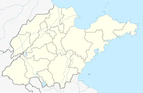 Dingtao Location in Shandong | |
| Coordinates: 35°08′33″N 115°35′28″E / 35.14250°N 115.59111°E | |
| Country | People's Republic of China |
| Province | Shandong |
| Prefecture-level city | Heze |
| Area | |
• Total | 846 km2 (327 sq mi) |
| Population (2019)[1] | |
• Total | 533,400 |
| • Density | 630/km2 (1,600/sq mi) |
| Postal Code | 274100 |
| Dingtao District | |||||||||
|---|---|---|---|---|---|---|---|---|---|
| Traditional Chinese | 定陶區 | ||||||||
| Simplified Chinese | 定陶区 | ||||||||
| |||||||||
| Huzi | |||||||||
| Chinese | 瓠子 | ||||||||
| Literal meaning | The Gourd | ||||||||
| |||||||||
Dingtao District is a district under the jurisdiction of Heze in Shandong province, China.
History
Under the Western Han, Dingtao was known as Huzi. The emperor Liu Bang's ill-fated consort Qi was from this area, and it was the scene of a 132 BC flood of the Yellow River.
Administrative divisions
As of 2012, this County is divided to 7 towns and 4 townships.
- Towns
|
|
- Townships
|
|
Climate
| Climate data for Dingtao, elevation 52 m (171 ft), (1991–2020 normals, extremes 1981–2010) | |||||||||||||
|---|---|---|---|---|---|---|---|---|---|---|---|---|---|
| Month | Jan | Feb | Mar | Apr | May | Jun | Jul | Aug | Sep | Oct | Nov | Dec | Year |
| Record high °C (°F) | 17.5 (63.5) |
25.1 (77.2) |
27.4 (81.3) |
32.4 (90.3) |
36.9 (98.4) |
39.9 (103.8) |
40.7 (105.3) |
36.2 (97.2) |
35.6 (96.1) |
34.3 (93.7) |
27.1 (80.8) |
20.3 (68.5) |
40.7 (105.3) |
| Mean daily maximum °C (°F) | 4.8 (40.6) |
8.8 (47.8) |
15.2 (59.4) |
21.1 (70.0) |
26.6 (79.9) |
31.7 (89.1) |
31.8 (89.2) |
30.5 (86.9) |
26.8 (80.2) |
21.6 (70.9) |
13.7 (56.7) |
6.8 (44.2) |
20.0 (67.9) |
| Daily mean °C (°F) | −0.4 (31.3) |
3.2 (37.8) |
9.3 (48.7) |
15.2 (59.4) |
20.8 (69.4) |
25.7 (78.3) |
27.1 (80.8) |
25.7 (78.3) |
21.1 (70.0) |
15.5 (59.9) |
8.0 (46.4) |
1.6 (34.9) |
14.4 (57.9) |
| Mean daily minimum °C (°F) | −4.2 (24.4) |
−1.0 (30.2) |
4.2 (39.6) |
9.8 (49.6) |
15.3 (59.5) |
20.4 (68.7) |
23.3 (73.9) |
22.1 (71.8) |
16.8 (62.2) |
10.9 (51.6) |
3.6 (38.5) |
−2.4 (27.7) |
9.9 (49.8) |
| Record low °C (°F) | −15.4 (4.3) |
−15.2 (4.6) |
−8.0 (17.6) |
−1.2 (29.8) |
4.2 (39.6) |
11.1 (52.0) |
16.8 (62.2) |
11.4 (52.5) |
5.7 (42.3) |
−0.8 (30.6) |
−11.4 (11.5) |
−13.2 (8.2) |
−15.4 (4.3) |
| Average precipitation mm (inches) | 7.2 (0.28) |
13.4 (0.53) |
16.2 (0.64) |
31.9 (1.26) |
51.6 (2.03) |
69.0 (2.72) |
178.2 (7.02) |
149.4 (5.88) |
76.2 (3.00) |
30.5 (1.20) |
25.2 (0.99) |
9.0 (0.35) |
657.8 (25.9) |
| Average precipitation days (≥ 0.1 mm) | 3.3 | 4.0 | 3.5 | 5.2 | 6.1 | 7.6 | 12.0 | 11.1 | 8.1 | 5.8 | 5.0 | 3.0 | 74.7 |
| Average snowy days | 3.5 | 2.9 | 0.6 | 0.2 | 0 | 0 | 0 | 0 | 0 | 0 | 0.8 | 1.9 | 9.9 |
| Average relative humidity (%) | 66 | 63 | 61 | 66 | 69 | 66 | 81 | 85 | 80 | 72 | 71 | 68 | 71 |
| Mean monthly sunshine hours | 133.7 | 148.0 | 201.0 | 219.9 | 240.6 | 226.6 | 199.8 | 191.4 | 178.5 | 167.3 | 151.7 | 143.1 | 2,201.6 |
| Percentage possible sunshine | 43 | 48 | 54 | 56 | 55 | 52 | 45 | 46 | 49 | 48 | 49 | 47 | 49 |
| Source: China Meteorological Administration[2][3] | |||||||||||||
Transportation
- Heze Mudan Airport, in Menghai Town
References
- ^ a b 最新人口信息 (in Chinese). hongheiku. Retrieved 2021-01-12.
- ^ 中国气象数据网 – WeatherBk Data (in Simplified Chinese). China Meteorological Administration. Retrieved 12 August 2023.
- ^ "Experience Template" 中国气象数据网 (in Simplified Chinese). China Meteorological Administration. Retrieved 12 August 2023.