Dešná (Jindřichův Hradec District)
Dešná | |
|---|---|
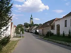 Main street | |
.svg.png) Flag  Coat of arms | |
 Dešná Location in the Czech Republic | |
| Coordinates: 48°57′27″N 15°32′34″E / 48.95750°N 15.54278°E | |
| Country | |
| Region | South Bohemian |
| District | Jindřichův Hradec |
| First mentioned | 1300 |
| Area | |
• Total | 37.74 km2 (14.57 sq mi) |
| Elevation | 466 m (1,529 ft) |
| Population (2025-01-01)[1] | |
• Total | 584 |
| • Density | 15/km2 (40/sq mi) |
| Time zone | UTC+1 (CET) |
| • Summer (DST) | UTC+2 (CEST) |
| Postal codes | 378 73, 378 81 |
| Website | www |
Dešná (German: Döschen) is a municipality and village in Jindřichův Hradec District in the South Bohemian Region of the Czech Republic. It has about 600 inhabitants.
Administrative division
Dešná consists of seven municipal parts (in brackets population according to the 2021 census):[2]
- Dešná (269)
- Bělčovice (42)
- Chvalkovice (50)
- Dančovice (47)
- Hluboká (28)
- Plačovice (29)
- Rancířov (111)
Demographics
| Year | Pop. | ±% |
|---|---|---|
| 1869 | 1,423 | — |
| 1880 | 1,453 | +2.1% |
| 1890 | 1,423 | −2.1% |
| 1900 | 1,393 | −2.1% |
| 1910 | 1,381 | −0.9% |
| 1921 | 1,557 | +12.7% |
| 1930 | 1,529 | −1.8% |
| 1950 | 1,140 | −25.4% |
| 1961 | 1,193 | +4.6% |
| 1970 | 1,075 | −9.9% |
| 1980 | 894 | −16.8% |
| 1991 | 716 | −19.9% |
| 2001 | 705 | −1.5% |
| 2011 | 613 | −13.0% |
| 2021 | 576 | −6.0% |
| Source: Censuses[3][4] | ||
References
- ^ "Population of Municipalities – 1 January 2025". Czech Statistical Office. 2025-05-16.
- ^ "Public Census 2021 – basic data". Public Database (in Czech). Czech Statistical Office. 2022.
- ^ "Historický lexikon obcí České republiky 1869–2011" (in Czech). Czech Statistical Office. 2015-12-21.
- ^ "Population Census 2021: Population by sex". Public Database. Czech Statistical Office. 2021-03-27.
External links
Wikimedia Commons has media related to Dešná (Jindřichův Hradec District).