D210 road
 | |
|---|---|
| Route information | |
| Length | 24.3 km (15.1 mi) |
| Major junctions | |
| From | |
| To | |
| Location | |
| Country | Croatia |
| Counties | Koprivnica-Križevci |
| Major cities | Virje |
| Highway system | |
D210 is a state road in Podravina region of Croatia connecting Gola and the nearby Gola border crossing[1] to Slovenia to the town of Virje on the D2 state road. The road is 24.3 km (15.1 mi) long.[2]
The road, as well as all other state roads in Croatia, is managed and maintained by Hrvatske ceste, state owned company.[3]
Traffic volume
Traffic is regularly counted and reported by Hrvatske ceste, operator of the road.[4]
| D210 traffic volume | ||||
| Road | Counting site | AADT | ASDT | Notes |
| 1402 Virje | 758 | 989 | Adjacent to the Ž2114 junction. | |
Road junctions and populated areas
| D210 junctions/populated areas | |
| Type | Slip roads/Notes |
| Gola The northern terminus of the road. | |
| Ždala | |
| Repaš Ž2116 to Novačka and Gola (D41). | |
| Drava Bridge - 372 m (1,220 ft) long. | |
| Molve Ž2114 to Hlebine and Drnje (D41). Ž2184 to Molve Grede and Grkine. | |
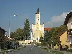
| Virje The southern terminus of the road. | |
Sources
- ^ a b "Map of border crossings and customs office areas" (PDF). Customs Administration of the Republic of Croatia (in Croatian). March 6, 2008. Archived from the original (PDF) on February 15, 2010. Retrieved August 10, 2010.
- ^ "Decision on categorization of public roads as state roads, county roads and local roads". Narodne novine (in Croatian). February 17, 2010.
- ^ "Public Roads Act". Narodne novine (in Croatian). December 14, 2004.
- ^ "Traffic counting on the roadways of Croatia in 2009 - digest" (PDF). Hrvatske ceste. May 1, 2010. Archived from the original (PDF) on July 21, 2011.