Culiacán Municipality
Municipality of Culiacán
Municipio de Culiacán | |
|---|---|
 Coat of arms | |
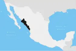
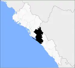 Location of the municipality in Sinaloa | |
| Coordinates: 24°48′29″N 107°23′49″W / 24.808°N 107.397°W | |
| Country | |
| State | |
| Foundation | 1915 |
| Seat | Culiacán Rosales |
| Government | |
| • Municipal president | Juan de Dios Gámez Mendivil |
| Area | |
• Total | 4,758 km2 (1,837 sq mi) |
| Population (2020[1]) | |
• Total | 1,003,530 |
| • Density | 180.5/km2 (467/sq mi) |
| Time zone | UTC-7 (Zona Pacífico) |
| Website | Culiacán Government page |
Culiacán is a municipality in the state of Sinaloa in northwestern Mexico, being the most populous municipality in Sinaloa.[2]
The municipal seat is the city of Culiacán.
Political subdivision
The municipality of Culiacán is subdivided into 17 sindicaturas:
- El Salado
- Higueras de Abuya
- Baila
- Aguaruto
- Emiliano Zapata
- Adolfo López Mateos (El Tamarindo)
- Jesús María
- Las Tapias
- Quilá
- Sanalona
- San Lorenzo
- Tacuichamona
- Tepuche
- Imala
- Costa Rica
- Culiacancito
- Las Flechas
Eldorado was formerly the eighteenth sindicatura of Culiacán, but it became an independent municipality in 2021.[3][4]
See also
 Media related to Culiacán Municipality at Wikimedia Commons
References
- ^ "¿Cuántos habitantes tiene... - Censo de Población y Vivienda 2020".
- ^ Enciclopedia de los Municipios de México. Instituto Nacional para el Federalismo y el Desarrollo Municipal https://web.archive.org/web/20070128142000/http://www.e-local.gob.mx/work/templates/enciclo/sinaloa/. Archived from the original on January 28, 2007. Retrieved January 11, 2010.
{{cite web}}: Missing or empty|title=(help) - ^ "DECRETO NÚMERO: 597" (PDF). El Estado de Sinaloa (in Spanish). Congress of Sinaloa. 22 March 2021. pp. 3–9. Retrieved 11 April 2024.
- ^ "Aprueba Congreso del Estado creación del municipio de Eldorado" (in Spanish). Congress of Sinaloa. 31 January 2023. Retrieved 4 January 2025.