Cope, Colorado
Cope, Colorado | |
|---|---|
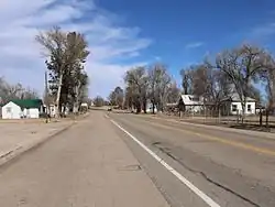 U.S. Route 36 in Cope (2017) | |
 Cope Location of the Cope CDP, Colorado.  Cope Cope (Colorado) | |
| Coordinates: 39°39′50″N 102°51′04″W / 39.6639°N 102.8510°W[2] | |
| Country | United States |
| State | Colorado |
| County | Washington[1] |
| Government | |
| • Type | unincorporated community |
| • Body | Washington County[1] |
| Area | |
• Total | 1.827 sq mi (4.731 km2) |
| • Land | 1.796 sq mi (4.651 km2) |
| • Water | 0.031 sq mi (0.080 km2) |
| Elevation | 4,403 ft (1,342 m) |
| Population | |
• Total | 53 |
| • Density | 29/sq mi (11/km2) |
| Time zone | UTC−07:00 (MST) |
| • Summer (DST) | UTC−06:00 (MDT) |
| ZIP code[5] | 80812 |
| Area codes | 970/748 |
| GNIS place ID | 195026 |
| GNIS town ID | 2805926 |
| FIPS code | 08-17100 |
Cope is an unincorporated town, a post office, and a census-designated place (CDP) located in and governed by Washington County, Colorado, United States. The population was 53 at the 2020 census.[4] The Cope post office has the ZIP Code 80812.[5]
History
The Cope, Colorado, post office opened on July 16, 1889.[6] The community was named after Johnathon C. Cope, a railroad official.[7]
Geography
Cope is located in Washington County at coordinates 39°39′50″N 102°51′04″W / 39.6639°N 102.8510°W and elevation 4,403 feet (1,342 m).[2]
At the 2020 United States Census, the Cope CDP had an area of 1,169 acres (4.731 km2), including 20 acres (0.080 km2) of water.[3]
Demographics
The United States Census Bureau defined the Cope CDP for the United States Census 2020.
| Year | Pop. | ±% |
|---|---|---|
| 2020 | 53 | — |
| Source: United States Census Bureau | ||
See also
- List of census-designated places in Colorado
- List of populated places in Colorado
- List of post offices in Colorado
References
- ^ a b "Colorado Counties". Colorado Department of Local Affairs. Retrieved July 26, 2025.
- ^ a b c "Cope, Colorado". Geographic Names Information System. United States Geological Survey, United States Department of the Interior. Retrieved July 26, 2025.
- ^ a b "State of Colorado Census Designated Places - BAS20 - Data as of January 1, 2020". United States Census Bureau. Retrieved December 27, 2020.
- ^ a b United States Census Bureau. "Cope CDP, Colorado". Retrieved April 5, 2023.
- ^ a b "ZIP Code Lookup". United States Postal Service. Retrieved July 26, 2025.
- ^ Bauer, William H.; Ozment, James L.; Willard, John H. (1990). Colorado Post Offices 1859–1989. Golden, Colorado: Colorado Railroad Historical Foundation. ISBN 0-918654-42-4.
- ^ Dawson, John Frank. Place names in Colorado: why 700 communities were so named, 150 of Spanish or Indian origin. Denver, CO: The J. Frank Dawson Publishing Co. p. 15.
External links
Wikimedia Commons has media related to Cope, Colorado.
Municipalities and communities of Washington County, Colorado, United States | ||
|---|---|---|
| Towns |  | |
| CDP | ||
| Unincorporated communities | ||
| Ghost towns |
| |