Col du Galibier
| Col du Galibier | |
|---|---|
 Col du Galibier (North view) | |
| Elevation | 2,642 m (8,668 ft) |
| Traversed by | D902B |
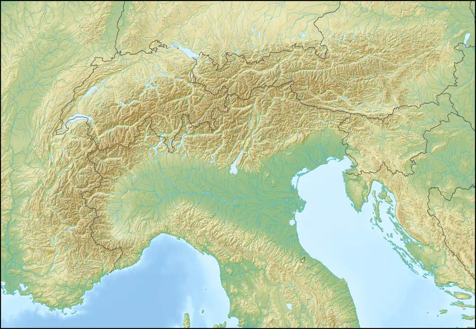
| Location | Savoie/Hautes-Alpes, France |
| Range | Graian Alps |
| Coordinates | 45°03′50.4″N 06°24′28.8″E / 45.064000°N 6.408000°E |
 Col du Galibier Location of Col du Galibier | |
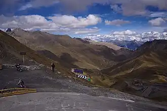
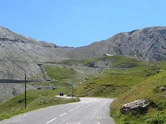
The Col du Galibier (el. 2,642 metres (8,668 ft))[1] is a mountain pass in the southern region of the French Dauphiné Alps near Grenoble. It is the eighth highest paved road in the Alps, and recurrently the highest point of the Tour de France.
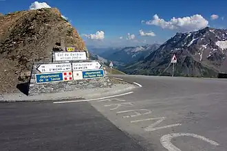
It connects Saint-Michel-de-Maurienne and Briançon via the col du Télégraphe and the Col du Lautaret. The pass is closed during the winter. It is located between the massif d'Arvan-Villards and the massif des Cerces, taking its name from the secondary chain of mountains known as the Galibier.
Before 1976, the tunnel was the only point of passage at the top, at an altitude of 2556 m. The tunnel was closed for restoration until 2002, and a new road was constructed over the summit. The re-opened tunnel is a single lane controlled by traffic lights, which are among the highest such installations in Europe.
History
In 1876 the first passable road was opened between Maurienne and Briançon in the Oisans region. In the north the pass road begins in Valloire, only reachable via the Col du Télégraphe which is before Galibier and connects Saint-Michel-de-Maurienne with Valloire. In the south, the road begins at a level of 2,057 m Col du Lautaret, which connects Grenoble in the west with Briançon in the east. The highest point of this road was at an altitude of 2,658 m, 16 meters higher than nowadays. The road between Col du Lautaret is 24,5 kilometers long, 16 kilometers is the northern part, 8,5 kilometers is the south part. The road over the Galibier was first a natural road, later asphalted.
Construction and opening of tunnel
The area of the summit was a difficult passage, therefore, in 1890, a 363-meter-long tunnel was built, which was opened in 1891. This tunnel is four meters wide, allowing only for the passage of vehicles in one direction at a time.
Details of the climb

From the north, starting at Saint-Michel-de-Maurienne (including the Col du Télégraphe), the climb is 34.8 kilometres (21.6 mi) long, gaining 2,120 metres (6,960 ft) in height (an average of 6.1%). The actual climb to the summit starts at Valloire and is 18.1 kilometres (11.2 mi) long at an average of 6.9% (height gain: 1,245 metres (4,085 ft)). The maximum gradient is 10.1% at the summit.[2]
From the south, the climb starts from the Col du Lautaret (el. 2,058 metres (6,752 ft)) and is 8.5 kilometres (5.3 mi) long at an average gradient of 6.9% (height gain: 585 metres (1,919 ft)) with a maximum of 12.1% at the summit.[3]
On both sides of the Col du Galibier, mountain pass cycling milestones are placed every kilometre. They indicate the distance to the summit, the current altitude, and the average slope in the following kilometre.
The Tour de France
The Col du Galibier was first used in the Tour de France in 1911; the first rider over the summit was Emile Georget, who, with Paul Duboc and Gustave Garrigou were the only riders not to walk.[4]
The original summit was at 2556 m.; while the tunnel was closed from 1976 until 2002, the tour route went only over the pass closer to the mountain peak at 2645 m. In 2011, the Tour de France went through the tunnel for the first time during the 19th stage from Modane Valfréjus to L'Alpe d'Huez.
At the south portal of the tunnel, at the edge of the road, there is a monument to Henri Desgrange, instigator and first director of the Tour de France. The memorial was inaugurated when the tour passed on 19 July 1949. Whenever the tour crosses the Col du Galibier, a wreath is laid on the memorial. The Souvenir Henri Desgrange is awarded to the first rider across the summit of the highest mountain in each year's tour. In 2006, the prize of 5,000 euros was claimed on the Col du Galibier by Michael Rasmussen.
Since 1947, the Col de Galibier has been crossed 31 times by the Tour de France. It was scheduled to be used in 1996, but was left out at the last minute due to bad weather. As a result of snow on both the Col de l'Iseran and the Col du Galibier, the scheduled 190 km stage from Val-d'Isère to Sestriere in Italy was reduced to a 46 km sprint from Le-Monetier-les-Bains which was claimed by Bjarne Riis, resulting in him taking the yellow jersey which he retained to the finish in Paris.
In the 2008 Tour, the Col du Galibier had been crossed on 23 July in the 210 km stage 17 from Embrun to Alpe d'Huez.[5]
The 2011 Tour climbed the Col du Galibier twice to celebrate the 100th anniversary of the first appearance of the pass in the Tour de France, including the first ever summit finish, won by Andy Schleck after a 60 km solo breakaway. This was the highest ever stage finish in the Tour de France.[6] It was scheduled to be used again in stage 20 of the 2015 Tour, but was left out nine days before the race start due to landslides in the Chambon Tunnel, situated towards the bottom of the descent of the climb. It was also used twice, on stages 11 and 12, of the 2022 Tour.[7]
Appearances in the Tour de France (since 1947)
The Giro d'Italia
The 2013 Giro d'Italia climbed the Col du Galibier, although the stage had to be shortened by 4 km due to heavy snowfall.[9]
See also
References
- ^ "Cols du Télégraphe et du Galibier".
- ^ "Col du Galibier from Saint Michel de Maurienne : 2642m". Cols-cyclisme. Retrieved 2025-08-01.
- ^ "Col du Galibier from Col du Lautaret : 2642m". Cols-cyclisme. Retrieved 2025-08-01.
- ^ Woodland, Les (2003). The Yellow Jersey companion to the Tour de France. Random House. p. 151. ISBN 0-224-06318-9.
- ^ "Tour de France: Sastre wins on Alpe D'Huez, takes lead". Cycling Weekly. July 23, 2008. Archived from the original on October 25, 2020. Retrieved May 17, 2024.
- ^ "Tour de France organisers unveil 2011 route to suit climbers". 19 October 2010.
- ^ "Why the Col du Galibier is such a classic Tour de France climb". Cyclist. Retrieved 13 July 2022.
- ^ "Le col du Galibier dans le Tour de France depuis 1947". www.ledicodutour.com (in French). Retrieved 2025-08-01.
- ^ Wynn, Nigel (May 19, 2013). "Giovanni Visconti wins Giro d'Italia's Col du Galibier stage". Cycling Weekly. Retrieved May 17, 2024.
Further reading
- Bacon, Ellis (2014). Mapping Le Tour. Glasgow: HarperCollins Publishers. pp. 290–291. ISBN 9780007543991. OCLC 872700415.
External links
- Complete list of leaders over summit Archived 2016-01-30 at the Wayback Machine (in French)
- A Cycling History of Galibier
- Profile from Valloire on climbbybike.com
- Profile from Col du Lautaret on climbbybike.com
- Cycling the Col du Galibier - tips and advice
- Col du Galibier cycling. Profiles and pictures (in French)
- CYCLEFILM's Video Reconnaissance of Galibier
- Grenoble Cycling Col du Galibier information page including profiles and images Archived 2011-07-21 at the Wayback Machine
- Video Cycling with snow
- Col du Galibier on Google Maps (Tour de France classic climbs)