Col de Marie-Blanque
| Col de Marie-Blanque | |
|---|---|
 | |
| Elevation | 1,035 m (3,396 ft)[1] |
| Traversed by | D294 |
| Location | Pyrénées-Atlantiques, France |
| Range | Pyrenees |
| Coordinates | 43°4′13″N 0°30′27″W / 43.07028°N 0.50750°W |
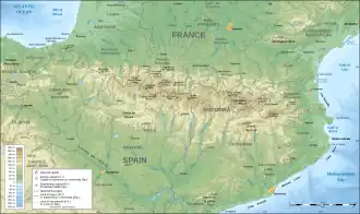 Col de Marie-Blanque Location in the Pyrenees | |
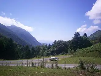
Col de Marie-Blanque (elevation 1,035 m (3,396 ft)) is a mountain pass in the western Pyrenees in the department of Pyrénées-Atlantiques in France. The pass is situated south-east of Oloron-Sainte-Marie and connects the valleys of the Aspe and the Ossau rivers.
Details of the climb
The western side of the climb, starts from Escot on the N134. The climb is 9.1 km (5.7 mi) long at an average gradient of 7.75% (height gain – 705 m (2,313 ft)). Although relatively short, there are several long sections with gradients in excess of 13%.[2]
From Louvie-Juzon (east), the climb is 15.0 km (9.3 mi) long. Over this distance, it gains 615 m (2,018 ft) at an average gradient of 4.1%. The climb proper starts at Bielle on the D934 from where it is 11.5 km (7.1 mi) long, gaining 585 m (1,919 ft) at an average gradient of 5.1%, with a maximum of 8.5% near the start. En route, the climb passes the Plateau de Bénou.[3]
Tour de France
The pass was first used in the Tour de France in 1978 and has been crossed 15 times by the tour, most recently in the 2023 Tour de France.[4]
Appearances in Tour de France
| Year | Stage | Category | Start | Finish | Leader at the summit |
|---|---|---|---|---|---|
| 2023 | 5 | 1 | Pau | Laruns | |
| 2020 | 9 | 1 | Pau | Laruns | |
| 2010 | 17 | 1 | Pau | Col du Tourmalet | |
| 2007 | 16 | 1 | Orthez | Gourette–Col d'Aubisque | |
| 2006 | 10 | 1 | Cambo-les-Bains | Pau | |
| 2005 | 16 | 1 | Mourenx | Pau | |
| 2000 | 10 | 1 | Dax | Hautacam | |
| 1996 | 17 | 2 | Argelès-Gazost | Pamplona | |
| 1995 | 16 | 2 | Tarbes | Pau | Stage neutralised |
| 1992 | 2 | 1 | San Sebastián | Pau | |
| 1990 | 17 | 1 | Lourdes | Pau | |
| 1989 | 9 | 1 | Pau | Cauterets | |
| 1987 | 14 | 1 | Pau | Luz-Ardiden | |
| 1987 | 13 | 1 | Bayonne | Pau | |
| 1986 | 12 | 1 | Bayonne | Pau | |
| 1978 | 10 | 2 | Biarritz | Pau |
References
- ^ IGN map
- ^ "Col de Marie Blanque from Escot : 1035m". Cols-cyclisme. Retrieved 2025-07-30.
- ^ "Col de Marie Blanque from Louvie Juzon : 1035m". Cols-cyclisme. Retrieved 2025-07-30.
- ^ a b "Le col de Marie-Blanque dans le Tour de France" (in French). ledicodutour. Retrieved 15 July 2022.