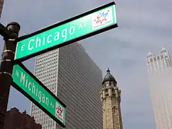
Chicago Avenue
| 800 North | |
 | |
| Length | 12.2 mi (19.6 km) |
|---|---|
| West end | 17th Avenue in Melrose Park |
| East end | |
Chicago Avenue is a major east–west street in Chicago, Illinois. In the Chicago street address system, it is at 800 north from 385 east to 5968 west, and continues west into the suburbs in several different suburban address systems.[1] Chicago Avenue starts at the shore of Lake Michigan at Lake Shore Drive (U.S. Route 41) in the Gold Coast neighborhood of Chicago, and runs west approximately 12.2 miles (19.6 km) to 17th Avenue in Melrose Park, Illinois.
Route description


Chicago Avenue has two lanes west of Austin Avenue, and the Chicago city limits, and roughly four lanes east of Austin Avenue.
Chicago Avenue runs just to the north of Westlake Hospital in Melrose Park. It then runs through Maywood and over the Des Plaines River before entering River Forest. Chicago Avenue is largely residential through River Forest and Oak Park, with a few small commercial strip malls and developments.
At Austin Avenue, Chicago Avenue becomes part of the addressing system for Chicago as 800 North, or 8 blocks (one mile) north of Madison Street. Chicago Avenue runs through the largely impoverished Austin and Humboldt Park neighborhoods. In the late 1940s and early 1950s at Chicago and Clark Streets, it was home to the first Puerto Rican immigrants to Chicago, who called the area "La Clark". East of about Kedzie Avenue, Chicago Avenue runs through the West Town and Near North Side areas.
Public transportation
Chicago Avenue is served by multiple Chicago Transit Authority (CTA) "L" lines: the Red Line (as Chicago), the Brown Line/Purple Line Express (as Chicago), and the Blue Line (as Chicago).[2]
The 66 Chicago is a CTA bus route that primarily travels along Chicago Avenue. It runs between Navy Pier (via Fairbanks Court) and Austin Boulevard.[2] On September 21, 2020, during the COVID-19 pandemic, the CTA began installing temporary "pop-up essential bus lanes" along a 4.6-mile-long (7.4 km) stretch on Chicago Avenue (Laramie Avenue to Ashland Avenue).[3][4][5] The bus lanes were made permanent in December 2022.[6] On April 2, 2021, the CTA began running battery electric buses along bus route 66, the first route to ever host them.[7][8]
References
- ^ Hayner, Don and Tom McNamee, Streetwise Chicago, "Chicago Avenue", p. 22., Loyola University Press, 1988, ISBN 0-8294-0597-6
- ^ a b "RTA System Map" (PDF). Regional Transportation Authority. Retrieved July 26, 2025.
- ^ Blumberg, Nick (September 21, 2020). "City Announces New Bus-Only Lanes to Reduce Crowding on 2 Busy Routes". WTTW. Retrieved July 26, 2025.
- ^ Evans, Maxwell (September 21, 2020). "CTA To Roll Out Dedicated Bus Lanes Along Chicago Avenue, 79th Street". Block Club Chicago. Retrieved July 26, 2025.
- ^ Greenfield, John (November 11, 2020). "Eyes on the Street: Chicago Ave. pop-up bus lanes aren't robust, but seem to be helping". Streetsblog Chicago. Retrieved July 26, 2025.
- ^ Greenfield, John (December 9, 2022). ""Pop-up" bus lanes on Chicago Ave. are now permanent, other upgrades planned citywide". Streetsblog Chicago. Retrieved July 26, 2025.
- ^ Greenfield, John (April 3, 2021). "Electric Feel: CTA is piloting six e-buses on the #66 route with smoother, quieter ride - Streetsblog Chicago". Streetsblog Chicago. Retrieved July 26, 2025.
- ^ "CTA Unveils New Electric Buses as Part of City's Green Initiatives". Chicago Transit Authority. Retrieved July 26, 2025.
External links
 Media related to Chicago Avenue at Wikimedia Commons