Cherso
Cherso
Χέρσο | |
|---|---|
_-_Hirsova_(anciennement)_%253B_Hirchova_(actuellement)_-_M%C3%A9diath%C3%A8que_de_l'architecture_et_du_patrimoine_-_APOR057882.jpg) The church photographed by the French Army in July 1916 | |
 Cherso Location within the regional unit 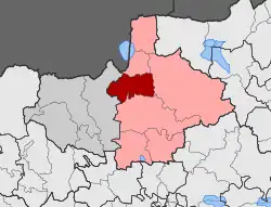 | |
| Coordinates: 41°05′N 22°47′E / 41.083°N 22.783°E | |
| Country | Greece |
| Administrative region | Central Macedonia |
| Regional unit | Kilkis |
| Municipality | Kilkis |
| Municipal unit | Cherso |
| Area | |
| • Municipal unit | 157.9 km2 (61.0 sq mi) |
| Population (2021)[1] | |
| • Municipal unit | 2,078 |
| • Municipal unit density | 13/km2 (34/sq mi) |
| • Community | 872 |
| Time zone | UTC+2 (EET) |
| • Summer (DST) | UTC+3 (EEST) |
| Postal code | 610 02 |
| Vehicle registration | ΚΙ |
Cherso (Greek: Χέρσο, old name: Greek: Χέρσοβο Bulgarian: Хърсово Hersovo / Hirsova) is a village in the Kilkis region of Greece. It is situated in the municipal unit of Cherso, in the Kilkis municipality, within the Kilkis region of Central Macedonia.
In 19th century the village was populated by Orthodox Christian Slavs, which were called Bulgarians by Bulgarian ethnogrtapher Vasil Kanchov.[2]
Since the 2011 local government reform (Kallikratis Plan), it has been part of the municipality Kilkis, of which it is a municipal unit.[3] The municipal unit has an area of 157.907 km2.[4] Population 2,078 (2021). In the municipal unit of Cherso lies the historical village of Kalindria.
In the area of Tumba Hrisafi, 1200 m northwest of the village, an ancient settlement was discovered, declared in 1996 a protected monument.[5]
Transport
The settlement is served by Hersos railway station, with services to Thessaloniki, Serres and Alexandroupoli.
References
- ^ "Αποτελέσματα Απογραφής Πληθυσμού - Κατοικιών 2021, Μόνιμος Πληθυσμός κατά οικισμό" [Results of the 2021 Population - Housing Census, Permanent population by settlement] (in Greek). Hellenic Statistical Authority. 29 March 2024.
- ^ В. Кѫнчовъ, Македония. Етнография и Статистика [Macedonia. Ethnography and Statistics]. Population tables
- ^ "ΦΕΚ B 1292/2010, Kallikratis reform municipalities" (in Greek). Government Gazette.
- ^ "Population & housing census 2001 (incl. area and average elevation)" (PDF) (in Greek). National Statistical Service of Greece. Archived from the original (PDF) on 2015-09-21.
- ^ "ΥΑ ΥΠΠΟ / ΑΡΧ / Α1 / Φ43 / 57683/3282 π.ε. / 17-4-1996 - ΦΕΚ 294 / Β / 3-5-1996". Permanent list of declared archaeological sites and monuments (in Greek). Archived from the original on 9 July 2021. Retrieved 26 June 2018.