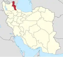
Chenar, Darrehrud
Chenar
Persian: چنار | |
|---|---|
Village | |
 Chenar | |
| Coordinates: 39°12′01″N 47°41′26″E / 39.20028°N 47.69056°E[1] | |
| Country | Iran |
| Province | Ardabil |
| County | Ungut |
| District | Darrehrud |
| Rural District | Darrehrud-e Shomali |
| Population (2016)[2] | |
• Total | 189 |
| Time zone | UTC+3:30 (IRST) |
Chenar (Persian: چنار)[a] is a village in Darrehrud-e Shomali Rural District[4] of Darrehrud District in Ungut County, Ardabil province, Iran.
Demographics
Population
At the time of the 2006 National Census, the village's population was 318 in 55 households, when it was in Angut-e Gharbi Rural District of Ungut District[b] in Germi County.[6][c] The following census in 2011 counted 246 people in 59 households.[7] The 2016 census measured the population of the village as 189 people in 57 households.[2]
In 2019, the district was separated from the county in the establishment of Ungut County and renamed the Central District. Chenar was transferred to Darrehrud-e Shomali Rural District created in the new Darrehrud District.[5]
See also
Notes
- ^ Also romanized as Chenār; also known as Jenār[3]
- ^ Renamed the Central District of Ungut County[5]
- ^ Formerly Moghan County
References
- ^ OpenStreetMap contributors (4 June 2025). "چنار, دهستان دره رود شمالی [Chenar, Darrehrud-e Shomali Rural District], Darrehrud District, Ungut County, Ardabil Province, Iran" (Map). OpenStreetMap (in Persian). Retrieved 4 June 2025.
- ^ a b سرشماري عمومي نفوس و مسكن 1395 : استان اردبیل [General Population and Housing Census 2016: Ardabil Province]. مرکز آمار ایران [Statistical Centre of Iran] (in Persian). Archived from the original (Excel) on 22 March 2019. Retrieved 19 June 2025.
- ^ Chenar can be found at GEOnet Names Server, at this link, by opening the Advanced Search box, entering "-3816454" in the "Unique Feature Id" form, and clicking on "Search Database".
- ^ Habibi, Hassan (28 May 2000) [تاریخ تصویب (Approval date) 1379/03/08 (Iranian Jalali calendar)]. ایجاد تغییرات و اصلاحات تقسیماتی در استان اردبیل [Making divisional changes and reforms in Ardabil province]. لام تا کام [Lam ta Kam] (in Persian). وزارت کشور [Ministry of the Interior]. هیات وزیران [Council of Ministers]. شناسه [ID] 60A86EC1-D1C3-42C1-B43F-D085CAA94D65. شماره دوره [Course number] 79. Archived from the original on 27 February 2024. Retrieved 19 June 2025.
- ^ a b Jahangiri, Ishaq (c. 2019) [Approved 18 September 2019]. Approval letter regarding national divisions in Germi County of Ardabil province. rc.majlis.ir (Report) (in Persian). Ministry of the Interior, Council of Ministers. Notification 104900/T57337H. Archived from the original on 24 June 2021. Retrieved 17 November 2023 – via Islamic Council Research Center.
- ^ سرشماري عمومي نفوس و مسكن 1385 : استان اردبیل [General Population and Housing Census 2006: Ardabil Province]. مرکز آمار ایران [Statistical Centre of Iran] (in Persian). Archived from the original (Excel) on 20 September 2011. Retrieved 19 June 2025.
- ^ سرشماري عمومي نفوس و مسكن 1390 : استان اردبیل [General Population and Housing Census 2011: Ardabil Province]. Iran Data Portal—Syracuse University (in Persian). مرکز آمار ایران [Statistical Centre of Iran]. Archived from the original (Excel) on 15 January 2023. Retrieved 19 June 2025.
