Caddo Gap, Arkansas
Caddo Gap, Arkansas | |
|---|---|
 Caddo Gap  Caddo Gap | |
| Coordinates: 34°24′16″N 93°37′18″W / 34.40444°N 93.62167°W | |
| Country | United States |
| State | Arkansas |
| County | Montgomery |
| Area | |
• Total | 0.40 sq mi (1.0 km2) |
| • Land | 0.40 sq mi (1.0 km2) |
| • Water | 0.0 sq mi (0 km2) |
| Elevation | 640 ft (200 m) |
| Population (2020)[3] | |
• Total | 39 |
| Time zone | UTC-6 (Central (CST)) |
| • Summer (DST) | UTC-5 (CDT) |
| ZIP code | 71935 |
| GNIS feature ID | 2805629[2] |
| FIPS Code | 05-10330 |
Caddo Gap is an unincorporated community and census-designated place (CDP) in Montgomery County, Arkansas, United States.[2] It lies between Glenwood and Norman, on the Caddo River. It was first listed as a CDP in the 2020 census with a population of 39.[3]
History
Caddo Gap is best known as the site where explorer Hernando de Soto and his forces clashed with the Native American Tula tribe in 1541, a group loosely affiliated with the Caddo Confederacy. The expedition described the Tula Indians as the fiercest they had encountered during their journey into North America.[4] After this, the expedition turned back east, reaching as far as the Mississippi River, where de Soto died. It remains unclear whether he died of fever or from a wound received during the fighting. The expedition held a secret burial ceremony and deposited his body in the river. A monument commemorating this event stands in the heart of the small community.[4]
Flood
During the night of June 10–11, 2010, a flash flood along Little Missouri River killed at least 20 people in the campgrounds of the Albert Pike Recreation Area near Caddo Gap.[5] In a matter of less than four hours water rose from 3 feet (0.91 m) to over 23 feet (7.0 m).
Education
Caddo Gap is in the Caddo Hills School District.[6][7]
Demographics
| Census | Pop. | Note | %± |
|---|---|---|---|
| 2020 | 39 | — | |
| U.S. Decennial Census[8] 2020[9] | |||
2020 census
| Race / Ethnicity (NH = Non-Hispanic) | Pop 2020[9] | % 2020 |
|---|---|---|
| White alone (NH) | 34 | 87.18% |
| Black or African American alone (NH) | 0 | 0.00% |
| Native American or Alaska Native alone (NH) | 1 | 2.56% |
| Asian alone (NH) | 0 | 0.00% |
| Pacific Islander alone (NH) | 1 | 2.56% |
| Some Other Race alone (NH) | 0 | 0.00% |
| Mixed Race or Multi-Racial (NH) | 2 | 5.13% |
| Hispanic or Latino (any race) | 1 | 2.56% |
| Total | 39 | 100.00% |
Notable people
References
- ^ "2021 U.S. Gazetteer Files: Arkansas". United States Census Bureau. Retrieved June 24, 2022.
- ^ a b c U.S. Geological Survey Geographic Names Information System: Caddo Gap, Arkansas
- ^ a b "P1. Race – Caddo Gap CDP, Arkansas: 2020 DEC Redistricting Data (PL 94-171)". U.S. Census Bureau. Retrieved June 24, 2022.
- ^ a b Carter, Cecile Elkins. Caddo Indians: Where We Come From. Norman: University of Oklahoma Press, 2001: 21. ISBN 0-8061-3318-X
- ^ "Home". CNN.com.
- ^ "General Highway Map Montgomery County, Arkansas" (PDF). Arkansas Department of Transportation. Archived from the original (PDF) on January 25, 2021. Retrieved February 25, 2021. - See Caddo Gap on the map.
- ^ "SCHOOL DISTRICT REFERENCE MAP (2010 CENSUS): Montgomery County, AR." U.S. Census Bureau. Retrieved on February 27, 2021. Compare with highway map for unincorporated areas.
- ^ "Decennial Census of Population and Housing by Decades". US Census Bureau.
- ^ a b "P2 Hispanic or Latino, and Not Hispanic or Latino by Race – 2020: DEC Redistricting Data (PL 94-171) – Caddo Gap CDP, Arkansas". United States Census Bureau.
- ^ The Encyclopedia of Arkansas-Osro Cobb
Municipalities and communities of Montgomery County, Arkansas, United States | ||
|---|---|---|
| City | 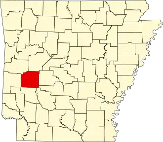 | |
| Towns | ||
| CDPs | ||
| Other unincorporated communities | ||
| Footnotes | ‡This populated place also has portions in an adjacent county or counties | |