Burray
| Old Norse name | Borgarey |
|---|---|
| Location | |
 Burray Burray shown within the Orkney Islands | |
| OS grid reference | ND460963 |
| Coordinates | 58°51′04″N 2°55′48″W / 58.851°N 2.93°W |
| Physical geography | |
| Island group | Orkney |
| Area | 903 hectares (3.5 sq mi) |
| Area rank | 55 [1] |
| Highest elevation | 80 metres (262 ft) |
| Administration | |
| Council area | Orkney Islands |
| Country | Scotland |
| Sovereign state | United Kingdom |
| Demographics | |
| Population | 445[2] |
| Population rank | 23 [1] |
| Population density | 49 people/km2[2][3] |
| Largest settlement | Burray Village |
| References | [3][4][5][6] |
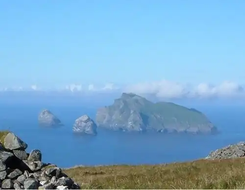
Burray (/ˈbʌriː/) is one of the Orkney Islands in Scotland. It lies to the east of Scapa Flow and is one of a chain of islands linked by the Churchill Barriers.
Geography and geology
Burray lies between Mainland, Orkney and South Ronaldsay, and is linked to both by the Churchill Barriers. Barriers 1, 2, and 3 connect Burray with Mainland, Orkney via the islets of Glimps Holm and Lamb Holm in Holm Sound to the north east. Barrier 4 links to South Ronaldsay, across Water Sound. To the west is the tidal island of Hunda, also joined by a causeway. Further west, across Scapa Flow, are the islands of Flotta and Calf of Flotta, approximately 6 kilometres (3.7 mi) away.
In 2001, the population of Burray was 357,[7] a total that had grown to 409 by 2011[8] and to 445 by 2022.[2] The main settlement, Burray Village, is a former fishing port on the south west coast. There are also settlements of Northtown, Southtown and Hillside on the island.
Burray is made up of Old Red Sandstone of the Devonian period.[3] The island is indented in the north west by Echnaloch Bay, which takes its name from Echna Loch. Burray Ness and Burray Haas are two headlands in the east.
Visitor attractions
Attractions in Burray include the Fossil and Heritage Centre at Viewforth.[9][10]
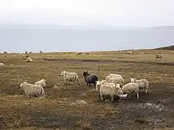
The island has a reasonable amount of birdlife, with Eurasian curlew, herring and lesser black-backed gulls breeding here.[3]
History
Viking history
One of the largest Viking hoards in Scotland[11] was discovered on 22 April 1889 by Mr G. Petrie, Little Wart, Burray when he was peat-cutting in the North Town Moss.[12] It consisted of over 140 items of silver bullion, including many fragments of arm ring or 'ring-money', and about a dozen coins[13] The date proposed for deposition is c. 998.[14]
Ecclesiastical land
In 1494/5 Bishop Andrew of Orkney was granted Burray by James IV. Bishop Andrew's successor Bishop Reid leased Burray and Flotta out on 19 year leases, a practice that had become common in Orkney in order to avoid the bishopric becoming too involved in the direct management of the land.[15]
Sir James Stewart
During the early 18th century, the laird of Burray was Sir James Stewart, who commenced signficant agricultural improvements in a 170 hectares (420 acres) enclosure called the Park of Cara.[16][note 1] Stewart was responsible for the murder of a political rival, James Moodie of Melsetter, in Kirkwall in 1725, and went on the run for twenty years. A Jacobite sympathiser, he fought in the Battle of Culloden and was one of the few survivors. However, when he returned to Burray after the battle, he happened to chance upon the son of the murder victim, who reported him to the authorities.[3][16] Stewart was arrested for treason (rather than murder), and ended up dying in a prison cell in London in June 1746.[18]
The novelist Mary Brunton was born Mary Balfour on Burray on 1 November 1778.[19]
WWII and construction of Churchill Barriers

On 14 October 1939, the Royal Navy battleship HMS Royal Oak was sunk at her moorings within the natural harbour of Scapa Flow, by the German submarine U-47 under the command of Günther Prien. U-47 had entered Scapa Flow through Holm Sound, just to the north of Burray, one of several eastern entrances to Scapa Flow. The eastern passages were protected by measures including sunken block ships, booms and anti-submarine nets, but U-47 entered at night at high tide by navigating between the block ships.
To prevent further attacks, the First Lord of the Admiralty, Winston Churchill ordered the construction of permanent barriers. Work began in May 1940 and the barriers were completed in September 1944, but were not officially opened until 12 May 1945, four days after the end of World War II.
The Churchill Barriers project required a substantial labour force, which peaked in 1943 at over two thousand. Much of the labour was provided by around 1200 Italian prisoners of war,[20] who had been captured in the desert war in North Africa, who were transported to Orkney from early 1942 onwards. As the use of POW labour for War Effort works is prohibited under the Geneva Conventions, the works were justified as 'improvements to communications' to the southern Orkney Islands.
The prisoners were accommodated in two camps, some at Camp 34 at Warebanks on Burray[21] and the rest at Camp 60 on Lamb Holm where the famous Italian Chapel was built. Camp 34 had its own chapel[22] but this was destroyed at the end of the war with the rest of the camp.[21] Photos exist of Camp 34's football team[23] and band.[24]
See also
References
- Notes
- ^ Park of Cara was a rectangular enclosure at the northern end of South Ronaldsay overlooking Burray.[17]
- Citations
- ^ a b Area and population ranks: there are c. 300 islands over 20 ha in extent. 93 permanently inhabited islands were listed in the 2011 census and 101 such islands in 2022.
- ^ a b c "Scottish Islands Data Dashboard". RESAS/Scottish Government. 2025. p. 6. Retrieved 1 June 2025.
- ^ a b c d e Haswell-Smith (2004) p. 358
- ^ Ordnance Survey: Landranger map sheet 6 Orkney (Mainland) (Map). Ordnance Survey. 2014. ISBN 9780319228128.
- ^ Anderson, Joseph (Ed.) (1893) Orkneyinga Saga. Translated by Jón A. Hjaltalin & Gilbert Goudie. Edinburgh. James Thin and Mercat Press (1990 reprint); ISBN 0-901824-25-9
- ^ Pedersen, Roy (January 1992) Orkneyjar ok Katanes (map) Inverness: Nevis Print
- ^ General Register Office for Scotland (28 November 2003) Scotland's Census 2001 – Occasional Paper No 10: Statistics for Inhabited Islands. Retrieved 26 February 2012.
- ^ National Records of Scotland (15 August 2013). "Appendix 2: Population and households on Scotland's Inhabited Islands" (PDF). Statistical Bulletin: 2011 Census: First Results on Population and Household Estimates for Scotland Release 1C (Part Two) (PDF) (Report). SG/2013/126. Retrieved 15 July 2025.
- ^ "The Churchill barriers". Living in Orkney. Archived from the original on 17 October 2008. Retrieved 30 August 2009.
- ^ "Orkney Fossil and Heritage". Archived from the original on 23 July 2011. Retrieved 3 July 2011.
- ^ "National Museums of Scotland – Hoard". nms.scran.ac.uk. Archived from the original on 6 January 2016. Retrieved 28 January 2015.
- ^ Historic Environment Scotland. "Burray, North Town Moss (Site no. ND49NE 5)". Retrieved 19 June 2025.
- ^ Graham-Campbell, J. A. "The Viking-age silver and gold hoards of Scandinavian character from Scotland" (PDF). archaeologydataservice.ac.uk. Archived (PDF) from the original on 21 May 2022. Retrieved 28 January 2015.
- ^ Cursiter, James W. "Notes on a hoard of silver ornaments and coins, discovered in the island of Burray, Orkney" (PDF). archaeologydataservice.ac.uk. Archived (PDF) from the original on 21 May 2022. Retrieved 28 January 2015.
- ^ Thomson (20080 pp. 252-53
- ^ a b Thomson (2008) pp. 336-37
- ^ William Aberdeen (1769). A chart of the Orkney Islands (Map). Edinburgh: National Library of Scotland. Retrieved 26 July 2025.
- ^ Seton & Gordon (1928) p. 122-23
- ^ "Floristic Synthesis of North America: Galium hypotrichium". Biota of North America Program (BONAP). BONAP. 2014. Retrieved 18 August 2025.
- ^ Custodis, Johann. "Exploiting the enemy in the Orkneys: the employment of Italian prisoners of war on the Scapa Flow barriers during the Second World War" (PDF). wrap.warwick.ac.uk. Archived (PDF) from the original on 17 June 2015. Retrieved 17 June 2015.
- ^ a b Historic Environment Scotland. "Warebank (Site no. ND49NE 43)". Retrieved 19 June 2025.
- ^ "The Italian Chapel". Scapa Flow Landscape Partnership Scheme. Archived from the original on 20 February 2015. Retrieved 4 March 2015.
- ^ "Italian Prisoner Of War Camp 34's Football Team". www.scran.ac.uk. Archived from the original on 2 April 2015. Retrieved 28 January 2015.
- ^ "Italian Prisoner Of War Band From Camp 34, Burray". www.scran.ac.uk. Archived from the original on 2 April 2015. Retrieved 28 January 2015.
- General references
- Haswell-Smith, Hamish (2004). The Scottish Islands. Edinburgh: Canongate. ISBN 978-1-84195-454-7.
- Seton, Sir Bruce Gordon; Arnot, Jean Gordon (1928). Prisoners of the 45. Vol. 1. Edinburgh: Scottish History Society.
- Thomson, William P.L. (2008). The New History of Orkney. Edinburgh: Birlinn.
External links
|  | ||||||||||||||||
|
| |||||||||||||||||
| |||||||||||||||||
| |||||||||||||||||
| |||||||||||||||||
| |||||||||||||||||
| |||||||||||||||||
| |||||||||||||||||