Bhuntar
Bhuntar | |
|---|---|
Town | |
 Bhuntar town | |
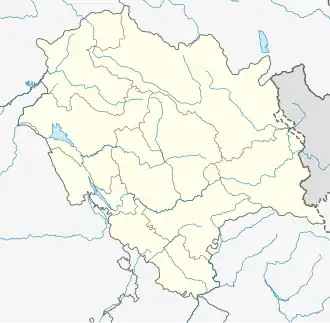
 Bhuntar Location in Himachal Pradesh, India  Bhuntar Bhuntar (India) | |
| Coordinates: 31°52′N 77°09′E / 31.86°N 77.15°E | |
| Country | |
| State | Himachal Pradesh |
| District | Kullu |
| Population (2011) | |
• Total | 4,475 |
| Languages | |
| • Official | Hindi |
| Time zone | UTC+5:30 (IST) |
| Vehicle registration | HP |
Bhuntar is a town and a nagar panchayat in Kullu district in the state of Himachal Pradesh, India. It is 11 km from the Kullu town, and lies along National Highway 3. The Kullu-Manali Airport is located in Bhuntar.
History
During the British Raj, Bhuntar had a bazaar and a branch office for post and telegraphs.[1]
In 1905, Duff Dunbar, a British forest officer posted in Kullu, got a suspension bridge constructed at Bhuntar over the Beas River. The bridge connected the Kullu valley to the Parvati valley. The bridge was rendered unserviceable by heavy floods in September 1947. Thakur Beli Ram, a local leader from Kullu, had to take care of this and other simultaneous issues in the wider Kullu region soon after India's Independence.[2]
Bhuntar was electrified alongside Kullu town in 1957. By 1961, Bhuntar already had an airstrip.[3]
Bhuntar was first categorized as a town by the Census of India 1981.[4]
Geography
Bhuntar is located on the right bank of the Beas River. Directly opposite Bhuntar, near the left bank of the Beas River, there is the confluence of the Parvati River with the River Beas. The Parvati Valley begins at this confluence and runs eastward, through a steep-sided valley towards Kasol and Manikaran.
The next major settlement after Bhuntar, in the direction of Kullu, is Shamshi.
Accessibility
Bhuntar lies on the National Highway 3, which till 2010 was the National Highway 21.
The airport at Bhuntar connects the Kullu valley to a few major north Indian cities like Delhi and Amritsar.
Bhuntar is a centre within the Kullu valley for accessing places in the Kullu valley such as Shamshi, Kullu, and Manali, and for places in the Parvati valley such as Manikaran, Kasol, and Tosh.
Demography
As of 2001 India census,[5] Bhuntar had a population of 5260. Males constitute 55% of the population and females 45%. Bhuntar has an average literacy rate of 80%, higher than the national average of 59.5%; with male literacy of 84% and female literacy of 76%. 11% of the population is under 6 years of age..
Climate
| Climate data for Bhuntar (Kullu–Manali Airport) 1991–2020, extremes 1960–present) | |||||||||||||
|---|---|---|---|---|---|---|---|---|---|---|---|---|---|
| Month | Jan | Feb | Mar | Apr | May | Jun | Jul | Aug | Sep | Oct | Nov | Dec | Year |
| Record high °C (°F) | 25.4 (77.7) |
28.2 (82.8) |
32.3 (90.1) |
37.3 (99.1) |
40.0 (104.0) |
39.4 (102.9) |
37.4 (99.3) |
37.8 (100.0) |
35.5 (95.9) |
33.6 (92.5) |
29.4 (84.9) |
27.0 (80.6) |
40.0 (104.0) |
| Mean daily maximum °C (°F) | 16.1 (61.0) |
18.3 (64.9) |
22.7 (72.9) |
27.3 (81.1) |
31.3 (88.3) |
32.9 (91.2) |
31.6 (88.9) |
30.8 (87.4) |
30.1 (86.2) |
27.9 (82.2) |
22.9 (73.2) |
18.2 (64.8) |
25.8 (78.4) |
| Mean daily minimum °C (°F) | 1.6 (34.9) |
3.8 (38.8) |
6.8 (44.2) |
9.8 (49.6) |
13.1 (55.6) |
17.0 (62.6) |
20.2 (68.4) |
19.9 (67.8) |
16.8 (62.2) |
10.1 (50.2) |
4.9 (40.8) |
1.5 (34.7) |
10.3 (50.5) |
| Record low °C (°F) | −4.7 (23.5) |
−4.5 (23.9) |
0.2 (32.4) |
3.5 (38.3) |
4.6 (40.3) |
6.1 (43.0) |
11.1 (52.0) |
10.9 (51.6) |
7.8 (46.0) |
3.5 (38.3) |
−1.5 (29.3) |
−5.2 (22.6) |
−5.2 (22.6) |
| Average rainfall mm (inches) | 81.4 (3.20) |
103.4 (4.07) |
116.7 (4.59) |
78.2 (3.08) |
61.3 (2.41) |
65.6 (2.58) |
135.6 (5.34) |
129.4 (5.09) |
77.4 (3.05) |
24.8 (0.98) |
21.6 (0.85) |
31.3 (1.23) |
926.9 (36.49) |
| Average rainy days | 4.9 | 6.3 | 7.6 | 6.3 | 5.8 | 5.6 | 8.8 | 9.5 | 5.2 | 1.6 | 1.9 | 2.0 | 65.5 |
| Average relative humidity (%) (at 17:30 IST) | 51 | 49 | 43 | 39 | 39 | 45 | 59 | 62 | 57 | 45 | 46 | 48 | 48 |
| Source: India Meteorological Department[6][7][8] | |||||||||||||
References
- ^ Punjab District and State Gazetteers: Part A]. Compiled and published under the authority of the Punjab government. 1918.
- ^ Shabab, Dilaram (1996). Kullu: Himalayan Abode of the Divine. Indus Publishing. p. 54. ISBN 978-81-7387-048-4.
- ^ Anand, R.L. (1970). Punjab District Census Handbook No. 7 - Kangra District. Government of Punjab.
- ^ Census of India 1981: A Portrait of Population Himachal Pradesh. Directorate of Census Operations, Shimla. 1981. p. 27.
- ^ "Census of India 2001: Data from the 2001 Census, including cities, villages and towns (Provisional)". Census Commission of India. Archived from the original on 16 June 2004. Retrieved 1 November 2008.
- ^ "Climatological Tables of Observatories in India 1991-2020" (PDF). India Meteorological Department. Retrieved 8 April 2024.
- ^ "Station: Bhuntar (A) Climatological Table 1981–2010" (PDF). Climatological Normals 1981–2010. India Meteorological Department. January 2015. pp. 145–146. Archived from the original (PDF) on 5 February 2020. Retrieved 15 February 2020.
- ^ "Extremes of Temperature & Rainfall for Indian Stations (Up to 2012)" (PDF). India Meteorological Department. December 2016. p. M67. Archived from the original (PDF) on 5 February 2020. Retrieved 15 February 2020.