Beyg Baghlu
Beyg Baghlu
Persian: بيگ باغلو | |
|---|---|
Village | |
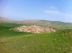 The village of Beyg Baghlu | |
 Beyg Baghlu | |
| Coordinates: 39°15′11″N 48°07′42″E / 39.25306°N 48.12833°E[1] | |
| Country | Iran |
| Province | Ardabil |
| County | Bileh Savar |
| District | Central |
| Rural District | Gug Tappeh |
| Population (2016)[2] | |
• Total | Below reporting threshold |
| Time zone | UTC+3:30 (IRST) |
Beyg Baghlu (Persian: بيگ باغلو)[a] is a village in Gug Tappeh Rural District[4] of the Central District in Bileh Savar County, Ardabil province, Iran.
Beyg Baghlu is between the two cities of Germi and Bileh Savar north of Ardabil, on the Iranian Azerbaijan–Republic of Azerbaijan border. The village is home to Beybagli tribe, one of the 32 tribes of the Turkish Shahseven tribal confederacy of Mughan. Its people are engaged in traditional farming and herding practices. Wheat, barley, lentils, and peas are grown. The village's dairy products are milk, cheese, butter, cream and yoghurt.
Demographics
Population
At the time of the 2006 National Census, the village's population was 19 in seven households.[5] The following census in 2011 counted the population as below the reporting threshold.[6] The 2016 census measured the population of the village again as below the reporting threshold.[2]
See also
Notes
References
- ^ OpenStreetMap contributors (11 May 2025). "بیگ باغلو (باجروان), دهستان گوگ تپه, بخش مرکزی [Beyg Baghlu, Bajravan, Gug Tappeh Rural District, Central District], Bilehsavar County, Iran" (Map). OpenStreetMap (in Persian). Retrieved 11 May 2025.
- ^ a b سرشماري عمومي نفوس و مسكن 1395 : استان اردبیل [General Population and Housing Census 2016: Ardabil Province]. مرکز آمار ایران [Statistical Centre of Iran] (in Persian). Archived from the original (Excel) on 22 March 2019. Retrieved 19 June 2025.
- ^ Beyg Baghlu can be found at GEOnet Names Server, at this link, by opening the Advanced Search box, entering "-3769800" in the "Unique Feature Id" form, and clicking on "Search Database".
- ^ Mousavi, Mir-Hossein (9 August 1987) [تاریخ تصویب (Approval date) 1366/05/18 (Iranian Jalali calendar)]. ایجاد و تشکیل تعداد 13 دهستان شامل روستاها، مزارع و مکانها در شهرستان مغان تابع استان آذربایجان شرقی [Creation and formation of 13 rural districts including villages, farms and places in Moghan County under East Azerbaijan province]. لام تا کام [Lam ta Kam] (in Persian). وزارت کشور [Ministry of the Interior]. هیات وزیران [Council of Ministers]. شناسه [ID] 519A4A8A-9894-4AA8-BDC0-B77F45FBF8F6. شماره دوره [Course number] 66, شماره جلد [Volume number] 13. Archived from the original on 18 June 2025. Retrieved 18 June 2025.
- ^ سرشماري عمومي نفوس و مسكن 1385 : استان اردبیل [General Population and Housing Census 2006: Ardabil Province]. مرکز آمار ایران [Statistical Centre of Iran] (in Persian). Archived from the original (Excel) on 20 September 2011. Retrieved 19 June 2025.
- ^ سرشماري عمومي نفوس و مسكن 1390 : استان اردبیل [General Population and Housing Census 2011: Ardabil Province]. Iran Data Portal—Syracuse University (in Persian). مرکز آمار ایران [Statistical Centre of Iran]. Archived from the original (Excel) on 15 January 2023. Retrieved 19 June 2025.
| Capital |  | ||||||||||||||||||||||
|---|---|---|---|---|---|---|---|---|---|---|---|---|---|---|---|---|---|---|---|---|---|---|---|
| Counties and cities |
| ||||||||||||||||||||||
| Landmarks |
| ||||||||||||||||||||||
| Places | |||||||||||||||||||||||