Benton Township, Holt County, Missouri
Benton Township | |
|---|---|
 | |
| Coordinates: 40°06′39″N 95°12′18″W / 40.1107172°N 95.2051337°W | |
| Country | United States |
| State | Missouri |
| County | Holt |
| Area | |
• Total | 50.18 sq mi (130.0 km2) |
| • Land | 49.82 sq mi (129.0 km2) |
| • Water | 0.36 sq mi (0.9 km2) 0.72% |
| Elevation | 981 ft (299 m) |
| Population | |
• Total | 1,294 |
| • Density | 26.0/sq mi (10.0/km2) |
| FIPS code | 29-08704672[1] |
| GNIS feature ID | 766761[2] |
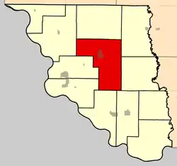
Benton Township is a township in Holt County, Missouri, United States.[2] At the 2020 census, its population was 1294.[3] It contains about 50 sections.[4] Mound City is the principal city of this township and is located in its center and the extinct hamlet of Jackson Point was located just south.
History
The present boundaries of Benton Township were set when neighboring Lincoln Township was organized on June 17, 1874.[4] There have been three post offices in this township: Jackson Point, which operated from 1850 to 1854, then North Point, which operated from 1855 to 1871, then in 1871 it was renamed Mound City.[5] The Kansas City, St. Joseph, and Council Bluffs Railroad was completed through this township in 1869.
References
- ^ a b "MO TIGER County Subdivisions". Missouri Spatial Data Infomration Service. United States Census Bureau. Retrieved April 21, 2025.
- ^ a b c U.S. Geological Survey Geographic Names Information System: Benton Township, Holt County, Missouri
- ^ a b "Census 2020 DHC Extract Assistance". Missouri Census Data Center. Retrieved April 21, 2025.
- ^ a b "History of Holt County, Missouri". St. Joseph, Mo., Midland Printing Co., 1917. Retrieved December 15, 2024.
- ^ "Post Offices". Jim Forte Postal History. Retrieved December 17, 2024.
Municipalities and communities of Holt County, Missouri, United States | ||
|---|---|---|
| Cities |  | |
| Villages | ||
| Townships | ||
| Unincorporated communities | ||
| Extinct Places | ||