Benton Township, Atchison County, Missouri
Benton Township | |
|---|---|
 | |
| Coordinates: 40°19′37″N 95°34′42″W / 40.3269443°N 95.5782739°W | |
| Country | |
| State | |
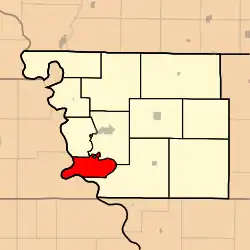
| County | Atchison |
| Area | |
• Total | 51.3 km2 (19.82 sq mi) |
| • Land | 49.9 km2 (19.28 sq mi) |
| • Water | 1.4 km2 (0.54 sq mi) 2.72% |
| Elevation | 267 m (876 ft) |
| Population | |
• Total | 17 |
| • Density | 0.3/km2 (0.9/sq mi) |
| FIPS code | 29-00504582[1] |
| GNIS feature ID | 766230[2] |
Benton Township is a township in Atchison County, Missouri, United States.[2] At the 2020 census, its population was 17.[3]
Benton Township was established in 1858, and named after Thomas Hart Benton, a Missouri senator.[4]
Geography
Benton Township covers an area of 19.8 square miles (51.3 km2) and contains no incorporated settlements.
The eastern boundary of the township was the old channel of the Nishnabotna River and the western boundary of the township is formed by the Missouri River.[5][6] The stream of State Line Slough runs through this northwestmost portion township.
References
- ^ a b "MO TIGER County Subdivisions". Missouri Spatial Data Infomration Service. United States Census Bureau. Retrieved April 21, 2025.
- ^ a b c U.S. Geological Survey Geographic Names Information System: Benton Township, Atchison County, Missouri
- ^ a b "Census 2020 DHC Extract Assistance". Missouri Census Data Center. Retrieved April 21, 2025.
- ^ "Atchison County Place Names, 1928-1945 (archived)". The State Historical Society of Missouri. Archived from the original on June 24, 2016. Retrieved August 30, 2016.
{{cite web}}: CS1 maint: bot: original URL status unknown (link) - ^ "History of Holt and Atchison counties, Missouri. 1882". St. Joseph, National Historical Co. Retrieved August 14, 2025.
- ^ "Plat book of Atchison County, Missouri 1930". Hixson (W. W.) and Company. Retrieved August 14, 2025.
External links
Municipalities and communities of Atchison County, Missouri, United States | ||
|---|---|---|
| Cities |  | |
| Village | ||
| Townships | ||
| Unincorporated communities | ||
| Extinct Hamlets | ||