Bear Claw Spire
| Bear Claw Spire | |
|---|---|
| Treasure Benchmark | |
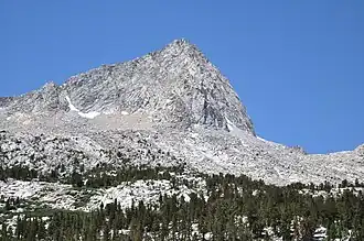 Northeast aspect | |
| Highest point | |
| Elevation | 12,578 ft (3,834 m)[1] |
| Prominence | 836 ft (255 m)[1] |
| Isolation | 1.06 mi (1.71 km)[1] |
| Coordinates | 37°19′45″N 118°45′27″W / 37.32921°N 118.7575°W[2] |
| Geography | |
 Bear Claw Spire Location in California  Bear Claw Spire Bear Claw Spire (the United States) | |
| Interactive map of Bear Claw Spire | |
| Country | United States of America |
| State | California |
| County | Fresno / Inyo |
| Protected area | John Muir Wilderness |
| Parent range | Sierra Nevada |
| Topo map | USGS Mount Hilgard |
| Geology | |
| Rock age | Mesozoic |
| Mountain type | Fault block |
| Rock type | Granite |
| Climbing | |
| First ascent | 1938 by Norman Clyde[3] |
| Easiest route | West slope[4] class 3[1] |
Bear Claw Spire, also known as Treasure Benchmark, is a mountain in California, United States.
Description
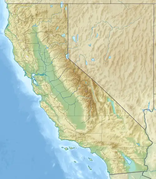
Bear Claw Spire is a 12,586-foot-elevation (3,836-meter) summit located in the John Muir Wilderness on the crest of the Sierra Nevada mountain range. It is situated on the common boundary shared by Fresno County with Inyo County, as well as the boundary that Sierra National Forest shares with Inyo National Forest. The peak is set 1.05 miles (1.69 km) northeast of Royce Peak, which is the nearest higher peak.[2] Precipitation runoff from the peak drains northeast into Honeymoon Lake → Pine Creek → Owens River, as well as south to Royce Lakes and the San Joaquin River watershed. Topographic relief is significant as the summit rises 2,150 feet (655 meters) above Honeymoon Lake in one mile (1.6 km), and 860 feet (262 meters) above the largest of the Royce Lakes in 0.3 mile (0.48 km). The summit ranks as the 274th-highest peak in California.[1] This landform's toponym has not been officially adopted by the U.S. Board on Geographic Names, so Bear Claw Spire, Treasure Benchmark, and Treasure Peak are commonly used names.
Climbing
The first ascent of the summit was made in 1938 via the west slope by Norman Clyde,[4] who is credited with 130 first ascents, most of which were in the Sierra Nevada.[5]
Established climbing routes with first ascents on Bear Claw Spire:[6]
- West Slope – class 3 – 1938 – Norman Clyde
- Northwest Face – class 5.7 – 1966 – Gary Colliver, Andy Lichtman, Mark Waller[4]
- Northeast Ridge – class 5.6 – 1982 – Galen Rowell[4]
- Treasure Hunt – class 5.9 – 2016 – Dave Nettle, Brandon Thau
- Treasure Iceland – class 5.4 – 2018 – Dane Steadman, Tyler Brillinski
- Fool's Gold – class 5.11 – 2023 – Brandon Adams, Cole Cunningham
Climate
According to the Köppen climate classification system, Bear Claw Spire is located in an alpine climate zone.[7] Weather fronts originating in the Pacific Ocean travel east toward the Sierra Nevada mountains. As fronts approach, they are forced upward by the peaks (orographic lift), causing them to drop their moisture in the form of rain or snowfall onto the range.
Gallery
-
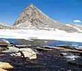 West aspect from Royce Lakes
 -
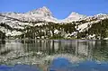 Bear Claw Spire (left) and Spire Peak (right) reflected in Honeymoon Lake
See also
References
- ^ a b c d e "Treasure Benchmark - 12,578' CA". listsofjohn.com. Retrieved August 11, 2025.
- ^ a b "Treasure Benchmark, California". Peakbagger.com. Retrieved August 11, 2025.
- ^ Hervey Voge, A Climber’s Guide to the High Sierra (1954), Retrieved August 11, 2025.
- ^ a b c d R. J. Secor, The High Sierra Peaks, Passes, Trails, 2009, Mountaineers Books, ISBN 9781594854811, p. 334.
- ^ "Norman Clyde - Mountaineer". OwensValleyHistory.com. Retrieved August 11, 2025.
- ^ Bear Claw Spire (Peak 12,563) Rock Climbing, Mountain Project, Retrieved August 11, 2025.
- ^ "Climate of the Sierra Nevada". Encyclopædia Britannica.
External links
- Bear Claw Spire Rock Climbing: Mountainproject.com
- Bear Claw Spire's summit block (photo): Flickr
Places adjacent to Bear Claw Spire | ||||||||||||||||
|---|---|---|---|---|---|---|---|---|---|---|---|---|---|---|---|---|
| ||||||||||||||||