Banwy
| Banwy | |
|---|---|
| Principal area | |
| Preserved county | |
| Country | Wales |
| Sovereign state | United Kingdom |
| Post town | WELSHPOOL |
| Postcode district | SY21 |
| Dialling code | 01938 |
| Police | Dyfed-Powys |
| Fire | Mid and West Wales |
| Ambulance | Welsh |
| UK Parliament | |
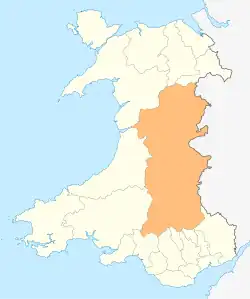
Banwy is a community in northwest Montgomeryshire, Powys, Wales,[1] named after the River Banwy and also called Banw in Welsh.
Geography
The community with the villages of Llangadfan and Foel,[1] also called Garthbeibio. It is a sparsely populated area centred on the village of Llangadfan and extending west for some 10 km to the boundary with Gwynedd. It is located along the upper River Banwy valley, on either side of the A458 road between Llanfair Caereinion and Mallwyd.[2]
The population according to the 2011 UK census was 605.[3] In 2005, the population was 534.[1]
History

Abernodwydd Farmhouse, a wooden-framed farmhouse built in 1678 from the Llangadfan was reassembled at the St Fagans National Museum of History.[4] Banwy was the site of Ffridd y Castell, or Ffriddycastell. The site is located 6 miles (9.7 km) southwest of Llangadfan.[5]
1977 F-111 crash
At Foel at 9.55pm on Monday 31 October 1977, a F-111 E crashed,[6] part of the 79th Tactical Fighter Squadron.[7]
- Air Flight Commander, Capt John James Sweeney (31 March 1948 - October 1977), aged 29, from Amsterdam, Ohio, he left Ohio State University College of Engineering in 1970
- Weapon Systems Officer, Capt William Weston Smart (26 May 1942 - October 1977), aged 35, from Pinellas County, Florida
References
- ^ a b c "Communities of Banwy and Llanerfyl" (PDF). Government of Powys. Retrieved 21 May 2017.
- ^ "Banwy". Google maps. Retrieved 21 May 2017.
- ^ "2011 Census Key Statistics, Banwy Community Council" (PDF). Government of Powys. Retrieved 21 May 2017.
- ^ "Abernodwydd farmhouse". National Museums Wales. Retrieved 21 May 2017.
- ^ "Ffridd y Castell (52.66864°, -3.52491) to Llangadfan". Google maps. Retrieved 21 May 2017.
- ^ Wolverhampton Express and Star Tuesday 1 November 1977, page 91
- ^ F-111 in 1977
External links
![]() Media related to Banwy at Wikimedia Commons
Media related to Banwy at Wikimedia Commons