Bang Krabue, Bangkok
| Bang Krabue | |
|---|---|
| บางกระบือ | |
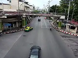 Bang Krabue Intersection view backward Si Yan area | |
| Location | |
| Thanon Nakhon Chai Si, Dusit, Bangkok, Thailand | |
| Coordinates | 13°47′21.74″N 100°30′52.65″E / 13.7893722°N 100.5146250°E |
| Roads at junction | Samsen (north–south) Amnuai Songkhram (east) Kheaw Khai Ka (west) |
| Construction | |
| Type | Four-way at-grade intersection with four-way footbridge |
Bang Krabue (Thai: บางกระบือ, pronounced [bāːŋ krā.bɯ̄ː]) is an intersection and neighbourhood in Bangkok's Thanon Nakhon Chai Si Sub-district, Dusit District.
Characteristics
This area is located at the four-corner junction where Samsen, Amnuai Songkhram, and Kheaw Khai Ka Roads meet. It lies midway between the Si Yan and Kiakkai Intersections on Samsen Road, and is home to Sappaya-Sapasathan, the current Parliament House of Thailand. In the future, it will be served by the Parliament House MRT station.
History
The name "Bang Krabue" translates to "community of water buffaloes". Historically, this area was a hub for cattle trading. Ranchers from the northeastern region of Thailand, known in the Isan dialect as nai hoi (นายฮ้อย), would drive herds of cattle toward the city, stopping first at Saphan Khwai and then finalizing deals here. The Thai word krabue (กระบือ), meaning "water buffalo", is a loanword from the Khmer language krabei (ក្របី).[1]
Bang Krabue occupies a section of Samsen Road running along the Chao Phraya River toward Bang Sue, near the border with Nonthaburi Province.
In the reign of King Rama V, Bang Krabue was a tambon (sub-district) with 13 muban (villages), administered under Bang Sue District in Phra Nakhon Province (modern-day Bangkok). The main transportation route at that time was the Khlong Bang Krabue canal, which connected the Chao Phraya River to the Khlong Prem Prachakon near the Bang Krabue temple bridge (Wat Bang Krabue).
During King Rama VI's reign, the area flourished with rice mills, ports, docks, and warehouses. It was also the original site of the liquor factory owned by Phraya Bhirom Bhakdi, now known as Boon Rawd Brewery. In winter, the area would become a seasonal habitat for large flocks of migratory gulls from the Northern Hemisphere.
Additionally, before 1968, Bang Krabue was served by two of Bangkok's tram lines, making it a key transport corridor of that era.[2][3]
Nearby places
- Boon Rawd Brewery
- Royal Irrigation Department
- Rajinibon School
- Wat Chan Samoson and Wat Chan Samoson School
- Makro Samsen
- Supreme Complex
References
- ^ "กระบือ (Water Buffalo)" (PDF). Faculty of Agriculture Ubon Ratchathani University (in Thai).
- ^ หนุ่มลูกทุ่ง (2009-04-21). "ส่อง(ย่าน)สรรพสัตว์ สืบประวัติอดีต กทม". ASTV Manager (in Thai). Archived from the original on 2018-04-04. Retrieved 2018-03-04.
- ^ บาราย (2015-06-14). "นางนวล อู่เรือ รถราง...บางกระบือ". Thairath (in Thai). Retrieved 2018-03-04.