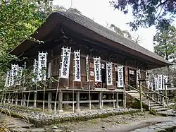
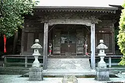
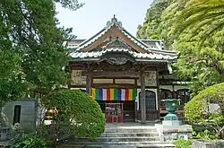
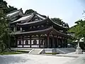
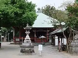
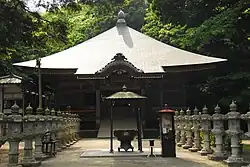
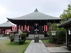
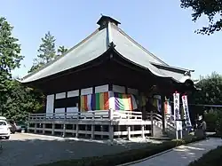
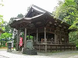
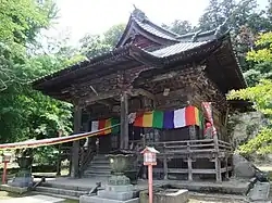
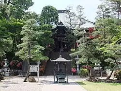
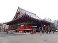
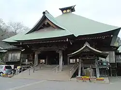
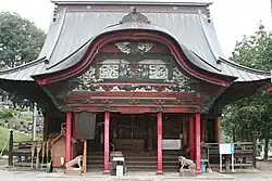
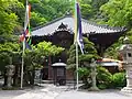
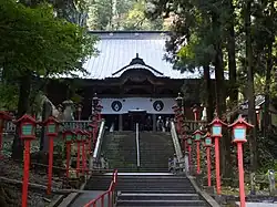
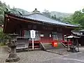
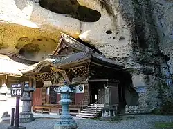
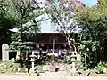
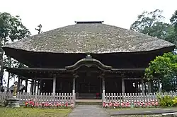
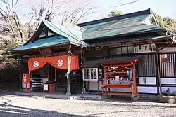
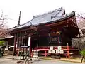
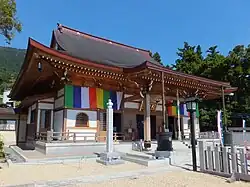
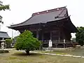
Bandō Sanjūsankasho
The Bandō Sanjūsankasho (坂東三十三ヵ所) is a pilgrimage of thirty-three Buddhist temples throughout the Kantō region of Japan, similar to the Saigoku Kannon Pilgrimage and the Shikoku Pilgrimage. From its beginning at Kamakura's Sugimoto-dera to its end in Chiba's Nago-ji, the circuit is over 1300 km long. The principal image of each temple in the route is Kannon Bosatsu, the Bodhisattva associated with compassion. [1] Kannon Bosatsu is the common Japanese name for Avalokiteśvara. She was first given the appellation "Goddess of Mercy" or "Mercy Goddess" by Jesuit missionaries in China.[2] There is considerable variation among the styles of images of Kannon Bosatsu, and the attributes each style possesses. The Bandō Sanjūsankasho is just one of over 70 different Kannon pilgrimage circuits existing in Japan, each including 33 temples because the goddess is believed to have 33 different manifestations.[3]
It is traditional for pilgrims to wear white clothing and conical straw hats and to carry walking sticks. While the route was historically traveled by foot, today pilgrims usually use cars or trains. Pilgrims record their progress with a prayer book (納経帖, Nōkyō-chō), which the temple staff mark with red stamps and Japanese calligraphy indicating the temple number, the temple name, and the specific name of the Kannon image. Some pilgrims receive the stamps and calligraphy on wall scrolls (for a decorative hanging) and on their white coats (to be cremated in) as well. Even though women were allowed to pray at individual temples, the circuit was originally reserved to male pilgrims.[3] Now however most of the pilgrims are women.[3] Pilgrims traditionally left behind a slip of paper or a sticker as a proof of their visit, and many of these can be seen plastered on temple walls and pillars.[4]
History
The origins of the Bandō Sanjūsankasho pilgrimage, as with the temples on the route, is uncertain. The foundation legends of at least ten temples on the route state that cloistered Emperor Kazan visited and designated them as temples on the circuit; however, it is highly improbable that Emperor Kazan visited the Kantō region in person. Emperor Kazan is known for having revived the Saigoku Kannon Pilgrimage after which the Bandō circuit is patterned. Any association between Emperor Kazan and any temple in the Bandō circuit only appears from the late Muromachi period, but this tradition was believed at least until the end of Edo period. For example, the "Bandō Kannon Sacred Place Record" written by Ryomori Samon states that when the Cloistered Emperor Kazan was praying at dawn at Hase-dera in Yamato Province, an old monk in a fragrant robe appeared and proclaimed that he was spirit of the Eight Provinces where Kannon Bosatsu appears in thirty-three places and told him to establish the circuit. [5]
Although there are no historical documents that clarify its history, it is known from the Azuma Kagami and other sources that Minamoto no Yoritomo was an extremely ardent believer in Kannon. Furthermore, Minamoto no Sanetomo was also known for his piety and his infatuation with all things from the Imperial Court in Kyoto. The fact that the first four temples in the circuit indicates a deep connection with the Kamakura shogunate. In 1192, when Yoritomo held the 49th memorial service for Cloistered Emperor Goshirakawal in Kamakura, 100 monks from various temples in the Kantō region attended, many of whom coming from temples listed on the Bandō Sanjūsankasho circuit. During the Kamakura period, pilgrimages to the Kumano shrines became very popular; however, few local samurai or minor warlords could afford to make the distant journey. Another impetus was that Tendai and Shingon temples were activity popularizing the concept of the pilgrimage, partly to offset the populist preachings of the new Pure Land and Nichiren movements. [5]
The first mention of the Bandō Sanjūsankasho in historical documentation is in 1234, only 15 years after Minamoto no Sanetomo's death, in an inscription found within a Kannon statue. This inscription states that a monk, probably a Shugendō, called Seiben, was on a pilgrimage to 33 places and carved a statue of Kannon. Many of the temples in the circuit have a connection with Shugendō, and in the Kamakura period, it appears that the pilgrimages on Bandō circuit were made by monk or senior samurai and there was little participation by the general public. This gradually changed in the Muromachi period, and a number of wooden pilgrimage tags left at various temples dated from the Bunmei era (1468-1482) have been found, some of which giving an address from places in Ōshu and other distant locations. At the end of the Muromachi period, pilgrimages to the "100 Kannon Temples"' began with the Bandō circuit added to the Saigoku circuit and the 34 temples of the Chichibu pilgrimage. This became even more popular during the Edo period, where guidebooks began to appear. [5]
The most noteworthy of the Edo period guides is the Sanjusansho Bandō Kannon Reibaki (三十三所坂東観音霊場記) in ten volumes written by the famous Shingon sect priest Ryōmori and was published in 1771. Ryōmori, who was chief priest at Nichirin-ji, claimed to have visited each temple several times, transcribing temple records, asking local elders about legends, and also collected records from local and foreign sources. He advised that it would take at least 40 days to complete the pilgrimage. It appears that the ordering of the 33 temples in the Bandō circuit has not changed since its inception, following the temples in numerical sequence has never been regarded as necessary and many Edo period guidebook noted that the total distance of the circuit was very long compared to the other pilgrimages and that the route was complicated to follow in order. [5]
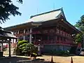
.JPG)
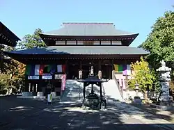
.jpg)

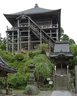
.jpg)
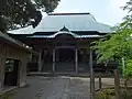
.jpg)
See also
- Japan 100 Kannon, pilgrimage composed of the Saigoku, Bandō and Chichibu pilgrimages
- Saigoku 33 Kannon, pilgrimage in the Kansai region.
- Chichibu 34 Kannon, pilgrimage in Saitama Prefecture
- Shikoku Pilgrimage, 88 Temple pilgrimage in the Shikoku island
- Musashino Kannon Pilgrimage, pilgrimage in Tokyo and Saitama prefectures
- Chūgoku 33 Kannon, pilgrimage in the Chūgoku region
- Kannon
- Buddhism in Japan
Notes
- ^ Yuichi Kobayashi (2020). 坂東三十三ヶ所札所めぐり 観音霊場巡礼ルートガイド. Meitsu shuppan. ISBN 4780426049.
- ^ Yu 2001, p. 371
- ^ a b c Donald Richie. Pilgrimage for the 21st century accessed on April 17, 2008 (in English)
- ^ Iso Mutsu
- ^ a b c d "三十三所坂東観音霊場記" (in Japanese). Bando Sanjusan Kannon official site. Retrieved December 20, 2023.
References
- Donald Richie. Pilgrimage for the 21st century accessed on April 17, 2008 (in English)
- Iso Mutsu. Kamakura: Fact and Legend, Tuttle Publishing (1995/06) ISBN 0-8048-1968-8 (in English)
- Yu, Chun-fang (2001). Kuan-yin, The Chinese Transformation of Avalokitesvara. New York, NY: Columbia University Press. ISBN 0-231-12029-X.
External links
- The Circuit's site (in Japanese)