Bahramabad Rural District
Bahramabad Rural District
Persian: دهستان بهرام آباد | |
|---|---|
 Bahramabad Rural District | |
| Coordinates: 35°35′N 51°16′E / 35.583°N 51.267°E[1][2] | |
| Country | Iran |
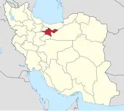
| Province | Tehran |
| County | Eslamshahr |
| District | Central |
| Established | 2012[3] |
| Capital | Bahramabad |
| Population (2016)[4] | |
• Total | 9,599 |
| Time zone | UTC+3:30 (IRST) |
Bahramabad Rural District (Persian: دهستان بهرام آباد) is in the Central District of Eslamshahr County, Tehran province, Iran. Its capital is the village of Bahramabad.[3]
History
Bahramabad Rural District was created in the Central District in 2012.[3]
Demographics
Population
At the time of the 2016 National Census, the rural district's population was 9,599 in 2,996 households. The most populous of its four villages was Shatareh, with 7,150 people.[4]
Other villages in the rural district
See also
References
- ^ OpenStreetMap contributors (23 July 2025). "Malekabad, Bahramabad RD, Eslamshahr Central District, Eslamshahr County, Tehran Province, 33187-17136, Iran" (Map). OpenStreetMap (in Persian). Retrieved 23 July 2025.
- ^ "H7M8+8MM Ahmadiyeh, Tehran, Tehran Province, Iran" (Map). Google Maps. Retrieved 23 July 2025.
- ^ a b c Rahimi, Mohammad Reza (15 April 2012) [تاریخ تصویب (Approval date) 1391/01/27 (Iranian Jalali calendar)]. تصویب نامه درخصوص تقسیمات کشوری در شهرستان اسلامشهر [Approval letter regarding national divisions in Eslamshahr County]. لام تا کام [Lam ta Kam] (in Persian). وزارت کشور [Ministry of the Interior]. هیات وزیران [Council of Ministers]. شماره ابلاغیه 11652/ت47594ه [Notification number 11652/T47594H]. Archived from the original on 21 June 2025. Retrieved 21 June 2025.
- ^ a b سرشماري عمومي نفوس و مسكن 1395 : استان تهران [General Population and Housing Census 2016: Tehran Province]. مرکز آمار ایران [Statistical Centre of Iran] (in Persian). Archived from the original (Excel) on 12 December 2021. Retrieved 25 June 2025.
| Capital | |||||||||||||||||||||||||||||
|---|---|---|---|---|---|---|---|---|---|---|---|---|---|---|---|---|---|---|---|---|---|---|---|---|---|---|---|---|---|
| Districts |
| ||||||||||||||||||||||||||||