Assiniboine River
| Assiniboine River | |
|---|---|
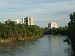 A view of the Assiniboine River looking southeast from the Maryland Bridge in Winnipeg | |
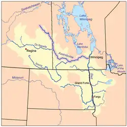 Red River drainage basin, with the Assiniboine River highlighted | |
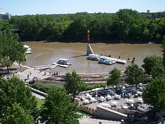
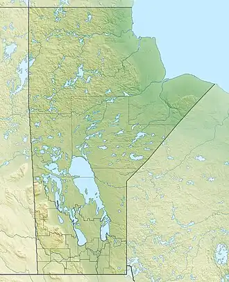 River mouth in Manitoba 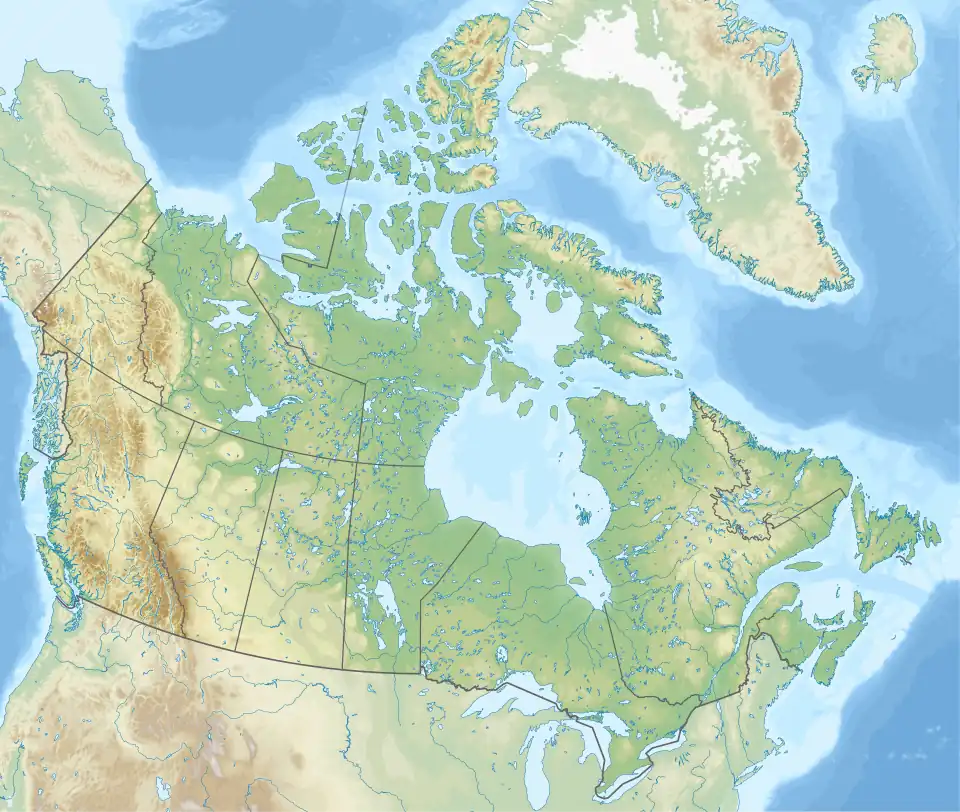 Assiniboine River (Canada) | |
| Location | |
| Country | Canada |
| Provinces | |
| Physical characteristics | |
| Source | Windy Lake east of Kelvington |
| • location | Saskatchewan |
| • coordinates | 52°18′15″N 103°06′01″W / 52.30417°N 103.10028°W |
| • elevation | 640 m (2,100 ft) |
| Mouth | Red River of the North |
• location | The Forks in Winnipeg, Manitoba |
• coordinates | 49°53′09″N 97°07′41″W / 49.88583°N 97.12806°W[1] |
• elevation | 230 m (750 ft) |
| Length | 1,070 km (660 mi) |
| Basin size | 182,000 km2 (70,000 sq mi) |
| Discharge | |
| • average | 45 m3/s (1,600 cu ft/s) |
| Basin features | |
| River system | Red River |
| The Atlas of Canada - Toporama[2] | |
The Assiniboine River (/əˈsɪnɪbɔɪn/ ə-SIN-ih-boyn; French: Rivière Assiniboine)[3] is a 1,070 km (660 mi) long river that runs through the prairies of Western Canada in Saskatchewan and Manitoba. It is a tributary of the Red River. The Assiniboine is a typical meandering river with a single main channel embanked within a flat, shallow valley in some places and a steep valley in others. Its main tributaries are the Qu'Appelle, Souris, and Whitesand Rivers.
The river takes its name from the Assiniboine, a First Nations peoples of the northern Great Plains. Robert Douglas of the Geographical Names Board of Canada (1933) made several comments as to its origin: "The name commemorates the Assiniboine natives called by La Vérendrye in 1730 'Assiniboils' and by Governor Knight in 1715 of the Hudson's Bay Company 'stone Indians.' Assiniboine is the name of an Indian tribe and is derived from 'assine' a stone and 'bwan' native name of the Sioux, hence Stony Sioux name was possibly given because they used heated stones in cooking their food."[4]
Course

The Assiniboine River rises in eastern Saskatchewan east of the community of Kelvington on the upper prairie level above the Manitoba Escarpment. The Assiniboine River flows through three basic zones with different channel characteristics. Upstream of Brandon, the main stem of the river and its most important tributaries flow within a very large valley. The valley was cut by huge glacial melt water flows at the end of the last glaciation. The floor of this spillway valley provides a natural floodplain for the river and the valley provides a significant storage volume making the construction of the Shellmouth Dam north of Russell both technically and economically viable. The major tributaries in this reach are the Qu'Appelle, Shell, and Little Saskatchewan Rivers.
The glacial flows created a large delta east of Brandon extending almost to Portage la Prairie. The river has eroded down through sediments of the delta cutting a narrow valley through these sediments as it drops through a vertical distance of about 150 m (490 ft) to the Lake Agassiz – Red River Plain. In this valley, the river is confined with a narrow valley floor. The Souris River is the primary tributary contributing flow to the Assiniboine in this reach.
Near Portage la Prairie the river emerges from the delta reach onto the relatively flat Red River plain (the floor of former glacial Lake Agassiz) and at this point it can flow in any direction from roughly northwest to roughly southeast. The gradient of the river channel within the delta reach to the west is relatively high, so the river water velocities are fairly high and the waters of the river carry significant amounts of sediment. The gradient in the flat Red River plain is much less and the velocity of the river water flowing over this plain is much lower. Therefore, the sediments carried by the river waters as they flow through the delta reach are deposited onto the plain. The Assiniboine winds its way east eventually joining the Red River at The Forks in Winnipeg, Manitoba.
Today, Assiniboine Herald at the Canadian Heraldic Authority is named after the river. Asessippi Provincial Park, an RV park was built on the east shore of the Shellmouth Reservoir.
The Assiniboine River has changed course numerous times over past centuries. It has followed its modern course for approximately 700 years. The Assiniboine River formerly met the Red River near the present-day mouth of the La Salle River. A Government of Manitoba report following the2011 Assiniboine River flood found that the flood "could have resulted in the river flowing east by a different route, possibly joining the Red River south of Winnipeg, or potentially even flowing north to Lake Manitoba as it did thousands of years ago," without the flood control infrastructure currently in place.[5]
Tributaries
Notable tributaries of the Assiniboine River include:
- Whitesand River, which joins it near Kamsack, Saskatchewan
- Lilian River, which joins it at Sturgis, Saskatchewan
- Souris River, which joins it near Wawanesa, Manitoba
- Birdtail Creek which joins at the Birdtail Sioux First Nation
- Little Saskatchewan River, which joins west of Brandon
- Qu'Appelle River, which joins near the historic Fort Ellice site of the Hudson's Bay Company
Flow rates and flood potential
There are three hydrometric stations on the river that have been taking measurements since 1913. The Assiniboine River near Headingley has an average discharge of 45 m3/s (1,600 cu ft/s).[6] One millimeter of runoff from half the watershed would take 70 hours to drain at flow rates of 360 m3/s (13,000 cu ft/s). The following discharge rates were recorded during the 1995 flood:[7]
| Location | Peak flow, 1995 | Mean flow, April 1995 | Mean flow, May 1995 | Max flow, date |
|---|---|---|---|---|
| Russell | 360 m3/s (13,000 cu ft/s) May 4 |
34.2 m3/s (1,210 cu ft/s) | 46.3 m3/s (1,640 cu ft/s) | 504 m3/s (17,800 cu ft/s) April 29, 1922 |
| Brandon | 566 m3/s (20,000 cu ft/s) April 26 |
81.1 m3/s (2,860 cu ft/s) | 104.0 m3/s (3,670 cu ft/s) | 651 m3/s (23,000 cu ft/s) May 7, 1923 |
| Headingley | 300 m3/s (11,000 cu ft/s) April 20 |
115.0 m3/s (4,060 cu ft/s) | 142.0 m3/s (5,010 cu ft/s) | 614 m3/s (21,700 cu ft/s) April 27, 1916 |
It is prone to spring flooding. Some flood flows can be diverted into Lake Manitoba at Portage la Prairie. In 1967, the Shellmouth Dam was built in Shellmouth to help reduce flood peaks and to supplement flows during dry periods. The Portage Diversion was completed in 1970. Despite these efforts, in May 2011 it was necessary to breach one of the dikes beside the river to relieve flood stresses east of Portage la Prairie. A Manitoba-wide state of emergency was declared in the wake of one in three hundred-year floods on the Assiniboine River at Brandon.[8][9][10] Below are the actual observed flow rates for major floods at different locations along the river:
| Location | 1882 peak flow[11][12] | 1976 peak flow[13] | 2011 peak flow[11] | 2014 peak flow[14][15] | 2017 peak flow[16][17][18] |
|---|---|---|---|---|---|
| Brandon | 1,200 m3/s (43,000 cu ft/s) | 610 m3/s (21,700 cu ft/s) | 1,040 m3/s (36,700 cu ft/s) | 1,101 m3/s (38,870 cu ft/s) | 670 m3/s (23,500 cu ft/s) |
| Portage la Prairie | 1,456 m3/s (51,414 cu ft/s) | 1,400 m3/s (49,000 cu ft/s) | 1,500 m3/s (53,100 cu ft/s) | 1,480 m3/s (52,100 cu ft/s) | 1,100 m3/s (39,000 cu ft/s) |
| Headingley | 910 m3/s (32,000 cu ft/s) | 610 m3/s (21,700 cu ft/s) | 540 m3/s (19,200 cu ft/s) | TBD | 435 m3/s (15,360 cu ft/s) |
- Note: Flows in 1882 occurred before any flood protection measures such as the Shellmouth Reservoir and Portage Diversion were built.
Looking specifically at the Assiniboine River at Portage La Prairie, where maximum river flows occur prior to historical spillovers (prior to construction of the Portage Diversion and the Lower Assiniboine River Dikes) into the watersheds of Lake Manitoba and the La Salle River, the top 10 calculated natural peak flow rates before construction of the current flood infrastructure are:
| Year | Calculated peak flow[12][18] |
|---|---|
| 1882 | 1,456 m3/s (51,414 cu ft/s) |
| 1902 | 915 m3/s (32,322 cu ft/s) |
| 1904 | 1,184 m3/s (41,806 cu ft/s) |
| 1974 | 853 m3/s (30,121 cu ft/s) |
| 1976 | 1,420 m3/s (50,137 cu ft/s) |
| 1995 | 893 m3/s (31,551 cu ft/s) |
| 2009 | 770 m3/s (27,202 cu ft/s) |
| 2011 | 1,702 m3/s (60,114 cu ft/s) |
| 2014 | 1,540 m3/s (54,369 cu ft/s) |
| 2017 | 1,143 m3/s (40,350 cu ft/s) |
Fish species
Fish species commonly found in the river include walleye, yellow perch, northern pike, mooneye, burbot, channel catfish, brown bullhead, rock bass, white sucker, shorthead redhorse, and common carp.
See also
- List of longest rivers of Canada
- List of rivers of Manitoba
- List of rivers of Saskatchewan
- Assiniboine River fur trade
References
- ^ "Assiniboine River at The Forks, Maitoba". Geographical Names Data Base. Natural Resources Canada.
- ^ "Atlas of Canada Toporama". Retrieved 29 August 2014.
- ^ "Rivière Assiniboine". Termium Plus. Public Works and Government Services Canada. 8 October 2009. Retrieved 3 September 2020.
- ^ R. Douglas, Place names of Manitoba, Geographic Board of Canada, Department of Interior, Canada, 1933
- ^ 2011 Flood: Technical Review of Lake Manitoba, Lake St. Martin and Assiniboine River Water Levels (PDF) (Report). Government of Manitoba. October 2013. p. 113.
- ^ Atlas of Canada. "Rivers of Canada". Archived from the original on 25 January 2008. Retrieved 15 February 2008.
- ^ Natural Resources Canada. "The Assiniboine River bursts its banks". Archived from the original on 3 February 2008. Retrieved 15 February 2008.
- ^ "Evacuees wait to return home as Brandon faces one-in-300-year flood". CTV News. 10 May 2011. Archived from the original on 2 March 2014. Retrieved 27 November 2020.
- ^ "(The Canadian Press)".
- ^ "Provincial State of Emergency Declared". CJOB 68. 9 May 2011. Archived from the original on 31 March 2012. Retrieved 27 November 2020.
- ^ a b "2011 Flood: Technical Review of Lake Manitoba, Lake St. Martin and Assiniboine River Water Levels" (PDF). Province of Manitoba. October 2013. p. 25. Retrieved 18 August 2025.
- ^ a b "MARCH OUTLOOK REPORT FOR MANITOBA March 23, 2018" (PDF). Province of Manitoba. 23 March 2018. Retrieved 18 August 2025.
- ^ "Daily Water Levels and Forecasts Assiniboine River June 22, 2012" (PDF). Province of Manitoba. 2012. Archived from the original (PDF) on 20 April 2013. Retrieved 25 July 2015.
- ^ "Summer Flood Bulletin #15". Province of Manitoba. 10 July 2014. Retrieved 18 August 2025.
- ^ "Flood Report For Manitoba - July 12, 2014" (PDF). Province of Manitoba. 12 July 2014. Archived from the original (PDF) on 14 July 2014.
- ^ "Flood Report For Manitoba - April 11, 2017" (PDF). Province of Manitoba. 11 April 2017. Archived from the original (PDF) on 18 April 2017.
- ^ "Daily Flood Sheet - April 17, 2017" (PDF). Province of Manitoba. 17 April 2017. Archived from the original (PDF) on 18 April 2017. Retrieved 24 August 2017.
- ^ a b "Red River Floodway Operation Report Spring 2017" (PDF). Province of Manitoba. 29 June 2017.
External links
- Fish Species of Saskatchewan
- Encyclopedia of Saskatchewan
 Media related to Assiniboine River at Wikimedia Commons