Aravaipa Canyon Wilderness
| Aravaipa Canyon Wilderness | |
|---|---|
.jpg) | |
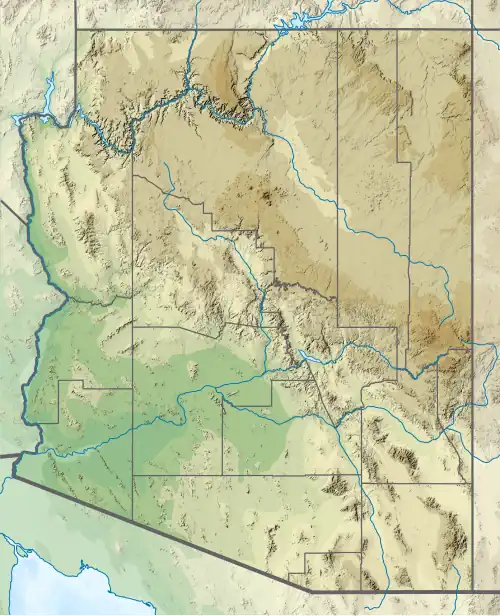 Location within Arizona  Location within United States | |
| Location | Graham / Pinal counties, Arizona, U.S. |
| Nearest city | Globe, Arizona |
| Coordinates | 32°53′49″N 110°29′15″W / 32.8970102°N 110.4875955°W[1] |
| Area | 19,700 acres (7,970 ha)[2] |
| Designated | 1984 |
| Governing body | Bureau of Land Management |
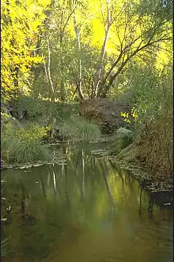
Aravaipa Canyon Wilderness is a 19,410 acres (7,850 ha) wilderness area located in the southeast portion of the U.S. State of Arizona between Tucson and Phoenix. There are two entrances to the area: the East Trailhead from U.S. Highway 70 between Safford and Bylas and the West Trailhead from Arizona Route 77 between Mammoth and Winkelman.[3] The Wilderness distinctively features the year-round flowing Aravaipa Creek that runs for 20 miles and supports a wide range of native desert wildlife.[4]
Access
The wilderness is administered by the BLM and is located northeast of Mammoth, Arizona in Graham and Pinal counties, about 120 miles (190 km) southeast of Phoenix. Pedestrian access to the preserve is allowed only with prior authorization from preserve staff. The area is popular for its recreation, especially its hiking trails and off-roading.[5][6] Visitors can hike to the abandoned cabin at the Parsons Grove site in the Aravaipa Canyon Preserve as of 2013.[7] Hiking in the canyon often requires creek crossings across Aravaipa Creek.
Geography
The Aravaipa Canyon Wilderness forms the northwest border of the Galiuro Mountain range. The wilderness includes the 11-mile (18 km) long Aravaipa Canyon, the surrounding tablelands and nine side canyons. The Nature Conservancy's Aravaipa Canyon Preserve protects 7,000 acres (28 km2) of private land and is contiguous with the BLM wilderness area.
Wildlife
Wildlife is abundant throughout the canyon. It has seven native species of fish of Arizona, as well as the lowland leopard frog, desert bighorn sheep, gila monster, western yellow-billed cuckoo, and Mexican spotted owl.
Permits and fees
A permit and fee are required to enter Aravaipa Canyon Wilderness. Use is limited to 50 people per day. Permits can be obtained from the BLM.
See also
References
- ^ "Aravaipa Canyon Wilderness". Geographic Names Information System. United States Geological Survey, United States Department of the Interior. Retrieved June 22, 2012.
- ^ "Designated Wilderness Within The National Landscape Conservation System As Of September 30, 2011" (PDF). Bureau of Land Management.
- ^ https://www.blm.gov/visit/aravaipa-canyon-wilderness
- ^ https://www.nature.org/en-us/get-involved/how-to-help/places-we-protect/aravaipa-canyon-preserve/?tab_q=tab_container-tab_element_1144174706
- ^ "Turkey Creek Trail". All Trails. 2019. Retrieved December 19, 2019.
- ^ "Parsons Grove & Canyon via Rug Road, AZ". 2019. Retrieved December 19, 2019.
- ^ "Rug Road Camping Trip Day 2, 6 April 2013". borntourist.com. Retrieved December 21, 2019.