Aneroid Mountain
| Aneroid Mountain | |
|---|---|
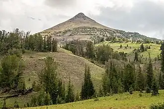 View from the meadows along the East Fork Wallowa River | |
| Highest point | |
| Elevation | 9,662 ft (2,945 m)[1] |
| Prominence | 2,102 ft (641 m)[2] |
| Parent peak | Hurwal Divide |
| Isolation | 5.85 mi (9.41 km)[2] |
| Coordinates | 45°12′12″N 117°10′29″W / 45.20333°N 117.17472°W[1] |
| Geography | |
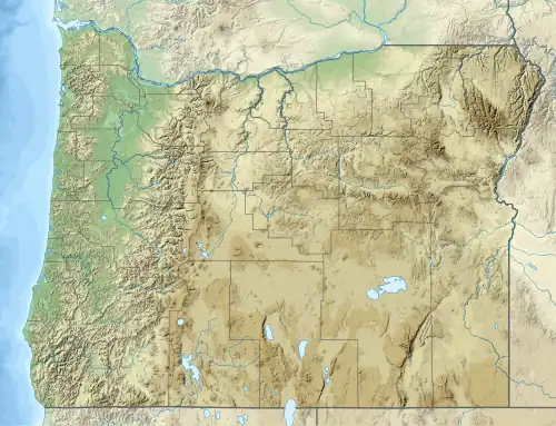 Aneroid Mountain Location in the state of Oregon | |
| Location | Oregon, United States |
| Parent range | Wallowa Mountains |
| Topo map | USGS Aneroid Mountain |
Aneroid Mountain is a 9,662-foot (2,945 m)[1] peak in the Wallowa Mountains, in Wallowa County, Oregon in the United States. It is located in the McCully Basin within the Eagle Cap Wilderness of the Wallowa National Forest, about 15 miles (24 km) south of Joseph.[2]
See also
References
- ^ a b c U.S. Geological Survey Geographic Names Information System: Aneroid Mountain
- ^ a b c "Aneroid Mountain". Peakbagger. Retrieved July 8, 2017.