Andrewsfield Aerodrome
Andrewsfield Aerodrome | |||||||||||||||
|---|---|---|---|---|---|---|---|---|---|---|---|---|---|---|---|
 Aerial image, 1991 | |||||||||||||||
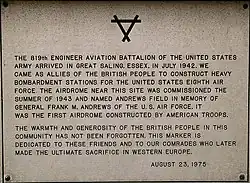 USAAF memorial plaque | |||||||||||||||
| Summary | |||||||||||||||
| Airport type | Private-owned, Public-use | ||||||||||||||
| Operator | Andrewsfield Aviation Ltd. | ||||||||||||||
| Serves | Braintree, Essex | ||||||||||||||
| Elevation AMSL | 286 ft / 87 m | ||||||||||||||
| Coordinates | 51°53′42″N 000°26′57″E / 51.89500°N 0.44917°E | ||||||||||||||
| Map | |||||||||||||||
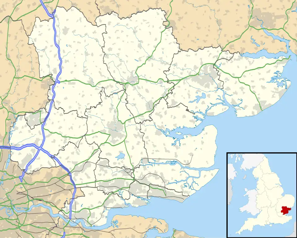 EGSL Location in Essex | |||||||||||||||
| Runways | |||||||||||||||
| |||||||||||||||
Andrewsfield Aerodrome (ICAO: EGSL) is an operational general aviation aerodrome located 4 NM (7.4 km; 4.6 mi) west northwest of Braintree, Essex, England, formerly RAF Andrews Field. Andrewsfield also functions as an important reliever airport for Stansted airport.
Andrewsfield has a CAA Ordinary Licence (Number P789) that allows flights for the public transport of passengers or for flying instruction as authorised by the licensee (Andrewsfield Air Operations Limited).[2]
Both the grass runways are 18 m (59 ft) wide and at night serve as a single 36 m (118 ft) runway. It has one orange windsock.
See also
- RAF Andrews Field the original World War II base
References
- ^ Andrewsfield – EGSL
- ^ "Civil Aviation Authority Aerodrome Ordinary Licences". Archived from the original (PDF) on 28 June 2007. Retrieved 30 May 2007.
See also
External links
Wikimedia Commons has media related to Andrewsfield Airport.