Ambarchik Bay
| Ambarchik Bay | |
|---|---|
| бухта Амбарчик (Russian) | |
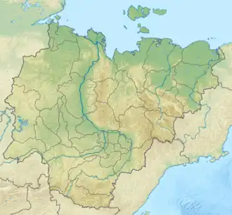 Ambarchik Bay Map showing the location of the bay | |
 | |
| Location | Far North |
| Coordinates | 69°39′N 162°18′E / 69.650°N 162.300°E |
| Ocean/sea sources | East Siberian Sea |
| Basin countries | Russia |
| Settlements | Ambarchik |
Ambarchik Bay (Russian: бухта Амбарчик) is a shallow bay in the eastern Kolyma Gulf in the East Siberian Sea. The location is within the Sakha Autonomous Republic, Russia, located approximately 1,700 kilometers (1,100 mi) (by air) north-east of Yakutsk. The port and polar station of Ambarchik (a transit station during the Gulag), is located on the coastline of the bay.[1]
In 1932 Dalstroi organised the Kolyma maritime division at the mouth of the river. In November that year prisoners from Sevvostlag began to build the wharves of a seaport in Ambarchik Bay. From 1932 to 1954 a transit camp was located there.
In 1993 a plaque in commemoration of the prisoners was erected there.[2]
Climate
| Climate data for Ambarchik Bay (extremes 1933-present) | |||||||||||||
|---|---|---|---|---|---|---|---|---|---|---|---|---|---|
| Month | Jan | Feb | Mar | Apr | May | Jun | Jul | Aug | Sep | Oct | Nov | Dec | Year |
| Record high °C (°F) | 8.6 (47.5) |
2.2 (36.0) |
3.2 (37.8) |
6.2 (43.2) |
24.3 (75.7) |
30.7 (87.3) |
32.8 (91.0) |
31.8 (89.2) |
21.7 (71.1) |
13.9 (57.0) |
4.3 (39.7) |
6.5 (43.7) |
32.8 (91.0) |
| Mean daily maximum °C (°F) | −25.9 (−14.6) |
−26.2 (−15.2) |
−19.8 (−3.6) |
−11.4 (11.5) |
−0.1 (31.8) |
9.6 (49.3) |
12.5 (54.5) |
10.3 (50.5) |
4.7 (40.5) |
−5.5 (22.1) |
−15.3 (4.5) |
−23.5 (−10.3) |
−7.5 (18.4) |
| Daily mean °C (°F) | −29.3 (−20.7) |
−29.3 (−20.7) |
−23.4 (−10.1) |
−15.4 (4.3) |
−3.7 (25.3) |
5.1 (41.2) |
7.8 (46.0) |
6.6 (43.9) |
2.0 (35.6) |
−8.1 (17.4) |
−18.5 (−1.3) |
−26.8 (−16.2) |
−11.1 (12.1) |
| Mean daily minimum °C (°F) | −32.4 (−26.3) |
−32.3 (−26.1) |
−27.0 (−16.6) |
−19.4 (−2.9) |
−7.0 (19.4) |
1.5 (34.7) |
4.0 (39.2) |
3.3 (37.9) |
−0.5 (31.1) |
−10.9 (12.4) |
−21.8 (−7.2) |
−29.9 (−21.8) |
−14.4 (6.2) |
| Record low °C (°F) | −49.5 (−57.1) |
−49.2 (−56.6) |
−46.1 (−51.0) |
−38.5 (−37.3) |
−30.0 (−22.0) |
−17.0 (1.4) |
−3.8 (25.2) |
−6.4 (20.5) |
−15.4 (4.3) |
−30.3 (−22.5) |
−41.7 (−43.1) |
−45.9 (−50.6) |
−49.5 (−57.1) |
| Average precipitation mm (inches) | 5.1 (0.20) |
3.9 (0.15) |
4.3 (0.17) |
3.2 (0.13) |
5.6 (0.22) |
11.5 (0.45) |
21.9 (0.86) |
19.6 (0.77) |
18.6 (0.73) |
14.6 (0.57) |
10.2 (0.40) |
6.0 (0.24) |
124.5 (4.89) |
| Source: pogoda.ru.net[3] | |||||||||||||
References
- ^ Great Soviet Encyclopedia, "Амбарчик" link
- ^ https://en.mapofmemory.org/14-12
- ^ "Климат Бухты Амбарчик" (in Russian). Retrieved December 23, 2022.