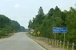
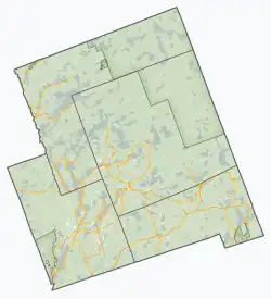
Algonquin Highlands
Algonquin Highlands | |
|---|---|
| Township of Algonquin Highlands | |
 | |
|
Logo | |
 Algonquin Highlands  Algonquin Highlands | |
| Coordinates: 45°24′N 78°45′W / 45.400°N 78.750°W | |
| Country | |
| Province | |
| County | Haliburton |
| Incorporated | January 1, 2001 |
| Government | |
| • Type | Township |
| • Mayor | Liz Danielsen |
| • Fed. riding | Haliburton—Kawartha Lakes |
| • Prov. riding | Haliburton—Kawartha Lakes—Brock |
| Area | |
| • Land | 999.69 km2 (385.98 sq mi) |
| Elevation | 443 m (1,453 ft) |
| Population (2021)[1] | |
• Total | 2,588 |
| • Density | 2.6/km2 (7/sq mi) |
| Time zone | UTC-5 (EST) |
| • Summer (DST) | UTC-4 (EDT) |
| Postal code | K0M 1S0 |
| Area code | 705 |
| Website | www |
Algonquin Highlands is a township located in Haliburton County, Ontario, Canada. It has a population of 2,351. The northeastern section of the township is included in Algonquin Provincial Park.
The township was formed on January 1, 2001, through the amalgamation of Stanhope and Sherborne et al. townships, the latter of which included McClintock, Livingstone, Lawrence and Nightingale. It was thereafter briefly known as the Township of Sherborne, Stanhope, McClintock, Livingstone, Lawrence and Nightingale until it was renamed to its current name in March 2001.[2]
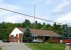
The township lacks a commercial center, but its municipal offices are located on North Shore Road, 5 kilometres (3.1 mi) north of Carnarvon at 45°05′09″N 78°41′36″W / 45.08583°N 78.69333°W. A satellite municipal office is located in Dorset, the main street of which straddles the border of Algonquin Highlands to the east and Lake of Bays to the west.
Communities
The largest community in the Municipality of Algonquin Highlands is Dorset, Ontario although this community is actually split with Lake of Bays, Ontario.
Geography
Located in Algonquin Provincial Park, the area is characterized by uplands and dense transitional forestation. It rests on a portion of the Canadian Shield.[3]
Climate
Algonquin Highlands experiences a humid continental climate, with it being more cool due to the higher elevation.[4]
Wildlife
The Algonquin Highlands support a wide range of wildlife due to their unique position at the transition zone between northern coniferous and southern deciduous forests. More than 50 species of mammals have been documented in the region.[5]
Large mammals commonly seen include moose, with a population of approximately 3,500, white-tailed deer , and black bears, which number around 2,000 and are typically shy and non-aggressive toward humans.[5][6] Beavers are widespread and play a significant ecological role in wetland maintenance, often observed from trails like Beaver Pond and Mizzy Lake.[5]
The area also provides habitat for the eastern wolf, a threatened species found in several packs within the region.[6] Smaller mammals such as otters, pine martens, red squirrels, chipmunks, raccoons, and foxes are also regularly seen, particularly in less-traveled areas.[5]
Beyond mammals, Algonquin Highlands are home to more than 270 bird species and over 30 species of reptiles and amphibians, reinforcing the area’s reputation as a premier location for wildlife observation in Ontario.[5][6]
Demographics
In the 2021 Census of Population conducted by Statistics Canada, Algonquin Highlands had a population of 2,588 living in 1,269 of its 3,325 total private dwellings, a change of 10.1% from its 2016 population of 2,351. With a land area of 999.69 km2 (385.98 sq mi), it had a population density of 2.6/km2 (6.7/sq mi) in 2021.[1]
| 2021 | 2016 | 2011 | |
|---|---|---|---|
| Population | 2,588 (+10.1% from 2016) | 2,351 (+7.5% from 2011) | 2,186 (+9.1% from 2006) |
| Land area | 999.69 km2 (385.98 sq mi) | 1,007.2 km2 (388.9 sq mi) | 1,004.76 km2 (387.94 sq mi) |
| Population density | 2.6/km2 (6.7/sq mi) | 2.3/km2 (6.0/sq mi) | 2.1/km2 (5.4/sq mi) |
| Median age | 60.4 (M: 60.4, F: 61.2) | 59.0 (M: 58.8, F: 59.2) | |
| Private dwellings | 3,325 (total) 1,269 (occupied) | 3,453 (total) | 3,878 (total) |
| Median household income | $77,000 | $60,877 |
| Year | Pop. | ±% |
|---|---|---|
| 1996 | 1,687 | — |
| 2001 | 1,827 | +8.3% |
| 2006 | 1,976 | +8.2% |
| 2011 | 2,186 | +10.6% |
| 2016 | 2,351 | +7.5% |
| 2021 | 2,588 | +10.1% |
| Source: Statistics Canada[1][10][11] | ||
Mother tongue (2021):[1]
- English as first language: 93.1%
- French as first language: 0.8%
- English and French as first language: 0.2%
- Other as first language: 5.0%
See also
References
- ^ a b c d e "Algonquin Highlands (Code 3546018) Census Profile". 2021 census. Government of Canada - Statistics Canada. Retrieved 2025-06-12.
- ^ "Municipal restructuring activity summary table - Dataset - Ontario Data Catalogue". data.ontario.ca. Government of Ontario. Retrieved 11 June 2025.
- ^ "Natural History | Frontenac Arch Biosphere". www.frontenacarchbiosphere.ca. Retrieved 2022-10-09.
- ^ Canada, Environment and Climate Change (2013-09-25). "Canadian Climate Normals 1981-2010 Station Data - Climate - Environment and Climate Change Canada". climate.weather.gc.ca. Retrieved 2022-10-09.
- ^ a b c d e "What kind of wildlife can be seen in Algonquin Park?". Algonquin Outfitters. Retrieved 2025-07-23.
- ^ a b c "Mammals | Algonquin Provincial Park | The Friends of Algonquin Park". www.algonquinpark.on.ca. Retrieved 2025-07-23.
- ^ "2021 Community Profiles". 2021 Canadian census. Statistics Canada. February 4, 2022. Retrieved 2023-10-19.
- ^ "2016 Community Profiles". 2016 Canadian census. Statistics Canada. August 12, 2021. Retrieved 2019-06-14.
- ^ "2011 Community Profiles". 2011 Canadian census. Statistics Canada. March 21, 2019. Retrieved 2012-02-13.
- ^ 1996, 2001, 2006 census
- ^ "Algonquin Highlands census profile". 2011 Census of Population. Statistics Canada. Retrieved 2012-02-13.
- "Algonquin Highlands". Geographical Names Data Base. Natural Resources Canada. Retrieved 2010-07-12.
- "Topographic Map sheets 31E2 & 31E7". Atlas of Canada. Natural Resources Canada. 2006-02-06. Archived from the original on 22 January 2009. Retrieved 2008-12-15.
External links
Places adjacent to Algonquin Highlands | ||||||||||||||||
|---|---|---|---|---|---|---|---|---|---|---|---|---|---|---|---|---|
| ||||||||||||||||
| Townships | 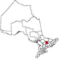 | |
|---|---|---|
| Communities | ||
| ||