2025 Sulawesi earthquake
 USGS ShakeMap | |
   | |
| UTC time | 2025-08-16 22:38:52 |
|---|---|
| USGS-ANSS | ComCat |
| Local date | 17 August 2025 |
| Local time | 06:38:52 WIT (UTC+8) |
| Magnitude | Mw 5.8 |
| Depth | 8.0 km (5 mi) |
| Epicenter | 1°16′55″S 120°43′37″E / 1.282°S 120.727°E |
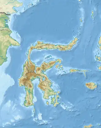
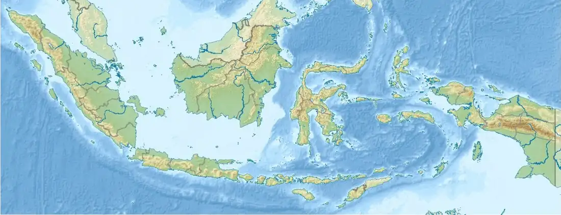
| Areas affected | Sulawesi, Indonesia |
| Max. intensity | MMI VI (Strong)[1] |
| Tsunami | 4.8 cm (1.9 in) |
| Casualties | 2 fatalities, 44 injuries |
On 17 August 2025, at 06:38:52 WIT, a Mww 5.8 earthquake struck the Indonesian province of Central Sulawesi about 12 km (7.5 mi) north northwest of the town of Poso.[2] The earthquake killed two people and injured at least 44 others, collapsed a church, damaged homes and buildings and triggered a minor tsunami in Poso Regency.
Tectonic setting
Sulawesi lies within the complex zone of interaction between the Australian, Pacific, Philippine, and Sunda plates in which many small microplates have developed.[3] The main active structure onshore in the western part of Central Sulawesi is the left-lateral NNW–SSE Palu-Koro strike-slip fault that forms the boundary between the North Sula, and Makassar blocks and was responsible for the destructive Palu earthquake in 2018.[4][5] According to the interpretation of Global Positioning System (GPS) data, the Makassar block is currently rotating anticlockwise, with its northwestern margin showing convergence with the Sunda block across the Makassar Strait. The main structure in that part of Sulawesi is the offshore, north–south trending, moderately east-dipping Makassar Thrust, also known as the Majene Thrust.[6] The GPS data also support the presence of a seismically "locked" fault in the Makassar Strait.[4] Seismic reflection data from the Makassar Strait supports the presence of active thrusting west of the Makassar block. The Majene/Kalosi fold-and-thrust belt is exposed onshore between Majene and Mamuju. The northern part of the Makassar Strait is interpreted as a foreland basin, with its subsidence caused by the loading of this active thrust belt.[7]
Earthquake
The quake measured 5.8 Mw, and had an epicenter just off the coast of Poso Regency in Central Sulawesi province, or 12 km (7.5 mi) north northwest of its capital of the same name. It struck 8.0 km (5.0 mi) below the surface, and had a maximum Modified Mercalli intensity of VI (Strong) in Poso, IV (Light) in Luwu Timur, Mamuju, Masamba, Majene, Palopo, Polman, and Pasangkayu, and III (Weak) in Tana Toraja and Wajo.[1] The quake was followed by 57 aftershocks as of 8:00 local time,[8] and triggered a small tsunami with a height of 4.8 cm (1.9 in).[9]
In July 14, one month prior to the August 17 quake and centered around 80 km (50 mi) south on Lake Poso, a magnitude 5.0 quake[10] in the same regency damaged 38 houses,[11] and ten days later a pair of Mw 5.5[12] and Mw 5.6[13] quakes injured four people, damaged 108 structures and caused power and telecommunication outages.[14][15][16]
Damage and casualties
Two people died and 44 others were injured, one of them in a critical condition, as a result of the earthquake.[17][18] Both of the fatalities[9] and 10 of the injured were congregants who were hit by fallen debris after a portion of a church under construction in the village of Masani collapsed on them while they were attending a Sunday service.[19] At least 208 homes were affected, including 64 which suffered severe damage, three which were moderately damaged and 141 which were slightly damaged.[20] In addition to the collapsed church, 28 other places of worship, including a mosque, three schools, a village office and a village health post was also damaged.[18][21][20]
See also
References
- ^ a b "Gempa M 5,8 di Sulteng, Skala Kerusakan Terbesar di Poso". CNN Indonesia (in Indonesian). 17 August 2025. Retrieved 17 August 2025.
- ^ ANSS. "M 5.8 - 15 km N of Poso, Indonesia 2025". Comprehensive Catalog. U.S. Geological Survey.
- ^ ANSS. "Sulawesi 2018: M 7.5 – 70 km N of Palu, Indonesia". Comprehensive Catalog. U.S. Geological Survey. Retrieved 28 September 2018.
- ^ a b Socquet A.; Simons W.; Vigny C.; McCaffrey R.; Subarya C.; Sarsito D.; Ambrosius B.; Spakman W. (2006). "Microblock rotations and fault coupling in Southeast Asia triple junction (Sulawesi, Indonesia) from GPS and earthquake slip vector data". Journal of Geophysical Research: Solid Earth. 111 (B8): B08409. Bibcode:2006JGRB..111.8409S. doi:10.1029/2005JB003963. Archived from the original on 19 January 2021. Retrieved 15 January 2021.
- ^ ANSS. "Sulawesi 2018 : M 7.5 – 70 km N of Palu, Indonesia". Comprehensive Catalog. U.S. Geological Survey. Retrieved 28 September 2018.
- ^ Bellier, O.; Sébrier, M.; Seward, D.; Beaudoin, T.; Villeneuve, M.; Putranto, E. (2006). "Fission track and fault kinematics analyses for new insight into the Late Cenozoic tectonic regime changes in West-Central Sulawesi (Indonesia)". Tectonophysics. 413 (3–4): 201–220. Bibcode:2006Tectp.413..201B. doi:10.1016/j.tecto.2005.10.036.
- ^ Bergman, S.C.; Coffield, D.Q.; Talbot, J.P.; Garrard, R.A. (1996). "Tertiary Tectonic and magmatic evolution of western Sulawesi and the Makassar Strait, Indonesia: evidence for a Miocene continent-continent collision". In Blundell, D.J.; Hall, R. (eds.). Tectonic Evolution of Southeast Asia. Geological Society, Special Publications. Vol. 106. pp. 391–429. doi:10.1144/GSL.SP.1996.106.01.25. ISBN 9781897799529. S2CID 140682113.
- ^ "Satu Korban Gempa Poso Meninggal di RS". Voice of Indonesia (in Indonesian). 18 August 2025. Retrieved 18 August 2025.
- ^ a b "6 Fakta Gempa M 5,8 Poso Tewaskan Pasutri dan 44 Warga Luka-luka" (in Indonesian). Detik.com. 20 August 2025. Retrieved 20 August 2025.
- ^ ANSS. "M 5.0 - 69 km NE of Masamba, Indonesia 2025". Comprehensive Catalog. U.S. Geological Survey.
- ^ "BPBD laporkan 38 rumah warga rusak akibat gempa di Poso Sulteng" (in Indonesian). Antara news. 15 July 2025. Retrieved 15 July 2025.
- ^ ANSS. "M 5.5 - 66 km S of Poso, Indonesia 2025". Comprehensive Catalog. U.S. Geological Survey.
- ^ ANSS. "M 5.6 - 60 km NNE of Masamba, Indonesia 2025". Comprehensive Catalog. U.S. Geological Survey.
- ^ "Ribuan Mengungsi, 4 Luka Ringan, dan 96 Gempa Susulan Terjadi di Poso" (in Indonesian). Berita Satu. 25 July 2025. Retrieved 25 July 2025.
- ^ "Dampak Gempa 5,7 Magnitudo, Poso Mati Listrik dan Rumah Hancur" (in Indonesian). Tribunnews. 25 July 2025. Retrieved 25 July 2025.
- ^ "Perkembangan Situasi dan Penanganan Bencana di Tanah Air Tanggal 27 Juli 2025" (in Indonesian). Badan Nasional Penanggulangan Bencana. 27 July 2025. Retrieved 28 July 2025.
- ^ "RSUD Poso: 2 Korban Meninggal Akibat Gempa M 5,8, 11 Dirawat" [Poso Regional Hospital: Two Victims Died in 5.8 Magnitude Earthquake, 11 Patients Under Treatment] (in Indonesian). Detik.com. 19 August 2025. Retrieved 19 August 2025.
- ^ a b "9 Desa Terdampak Gempa Poso, Total 57 Gempa Susulan hingga Senin Pagi" [9 Villages Affected by Poso Earthquake, Total 57 Aftershocks as of Monday Morning] (in Indonesian). CNN Indonesia. 18 August 2025. Retrieved 18 August 2025.
- ^ "Satu Korban Gempa Poso Meninggal Dunia, Diumumkan Pemerintah Desa Masani Lewat Pengeras Suara" (in Indonesian). Jawa Pos. 17 August 2025. Retrieved 17 August 2025.
- ^ a b "Update Dampak Gempa Poso M 5,8: 208 Rumah Warga-28 Rumah Ibadah Rusak". Detik.com (in Indonesian). 18 August 2025. Retrieved 19 August 2025.
- ^ "[UPDATE]: Gempa Bumi M 6.0 Poso, Warga Luka-Luka Bertambah Jadi 32 Orang". Badan Nasional Penanggulangan Bencana (in Indonesian). 17 August 2025. Retrieved 17 August 2025.