2003 Zhaosu earthquake
  | |
| UTC time | 2003-12-01 01:38:31 |
|---|---|
| ISC event | 7195925 |
| USGS-ANSS | ComCat |
| Local date | 1 December 2003 |
| Local time | 06:38:31 Kazakhstan time (UTC+5) 09:38:31 CST (UTC+8) |
| Magnitude | Ms 6.1 Mw 6.0 |
| Depth | 15 km (9.3 mi) |
| Epicenter | 42°54′18″N 80°30′54″E / 42.905°N 80.515°E |
| Type | Reverse |
| Areas affected | Raiymbek, Kazakhstan and Zhaosu, China |
| Total damage | ¥100–500 million (US$14–70 million, equivalent to $32.6–122.7 million in 2005) |
| Max. intensity | CSIS VIII (MMI IX) |
| Aftershocks | 145 (as of 30/12/2003) |
| Casualties | 11 dead, 73 injured |
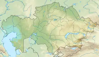
A Ms 6.1 earthquake struck the China–Kazakhstan border region on 1 December 2003 at 01:38 UTC. The epicenter was located in Raiymbek District, Almaty Region, Kazakhstan, just 2 km (1.2 mi) from the border with Zhaosu County, Xinjiang, China.[1]
Tectonic setting
The Tien Shan mountains in Central Asia formed as a result of thrusting and folding of the continental crust during the Late Cenozoic era. Around this time, the Indian subcontinent is colliding with Asia along a 2,500 km long convergent boundary known as the Main Himalayan Thrust. The ongoing collision of India into the Eurasian plate has resulted in extreme internal deformation of the continental crust. Deformation has induced large-scale intraplate shear and thrust faulting far from the plate boundary. Thrusting along the Tien Shan mountains has shortened the crust by an average velocity of 13 ± 7 mm/yr.[2] In some areas such as the Western Tien Shan, the shortening rate is as high as 23 mm/yr, however in the northern region, that rate is much slower at just 6 mm/yr.[3]
Earthquake
The United States Geological Survey (USGS) and International Seismological Centre (ISC) both reported a moment magnitude (Mw ) of 6.0,[4][5] while the China Earthquake Administration put the magnitude at Ms 6.1.[6] The ISC reported a depth of 15 km (9.3 mi).[5] The earthquake occurred on a reverse fault. By 30 December, 145 aftershocks were recorded, including two exceeding ML 5.0.[7]
The earthquake had a maximum observed intensity of IX (Violent) on the Modified Mercalli intensity scale, according to the United States Geological Survey.[8] A survey conducted by the China Earthquake Administration determined that the earthquake had a maxinum intensity of VIII on the China seismic intensity scale (CSIS), based on the severity of damage to homes, several stations and sheep pens in Zhaosu County. In Kazakhstan, a maxinum intensity of VII (Very strong) on the Medvedev–Sponheuer–Karnik scale was recorded in the village of Sumbe, near the epicenter.[7] Tremors were also felt in Almaty and parts of Kyrgyzstan.[9]
Impact
Eleven people were killed in the earthquake,[10] with 73 others injured, 26 of them seriously.[6] Most of the victims were killed after their homes collapsed, with four children among the dead.[9] A total of 6,200 people were affected, 80% of whom were ethnic Mongols, with 800 homes destroyed, 200 schools damaged and 247 livestock killed. The worst-affected areas were the townships of Tianshan and Xiata in Zhaosu County. The earthquake caused losses of ¥100–500 million (US$14–70 million).[6] Ground fissures formed near the epicenter.[7] With the earthquake occurring in the cold winter, relief efforts were hampered by low temperatures and up to 30 cm (12 in) of snowfall covering roads in the epicenter region.[10] Homes also collapsed in the village of Sumbe in Raiymbek District, Kazakhstan.[7]
See also
- List of earthquakes in 2003
- List of earthquakes in China
- List of earthquakes in Kazakhstan
- 2003 Bachu earthquake
- 2024 Uqturpan earthquake
References
- ^ Tanatkan, Abakanov (2007). "Seismological researches in Republic of Kazakhstan" (PDF). Institute of Seismology. Archived from the original (PDF) on March 28, 2012. Retrieved April 13, 2013.
- ^ Avouac, J. P.; Tapponnier, P.; Bai, M.; You, H.; Wang, G. (10 April 1993). "Active Thrusting and Folding Along the Northern Tien Shan and Late Cenozoic Rotation of the Tarim Relative to Dzungaria and Kazakhstan" (PDF). Journal of Geophysical Research: Solid Earth. 98 (B4): 6755–6804. Bibcode:1993JGR....98.6755A. doi:10.1029/92JB01963. Retrieved 17 March 2021.
- ^ Wang, Chun-Yong; Yang, Zhu-En; Luo, Hai; Mooney, W.D. (2004). "Crustal structure of the northern margin of the eastern Tien Shan, China, and its tectonic implications for the 1906 M~7.7 Manas earthquake" (PDF). Earth and Planetary Science Letters. 223 (1–2): 187–202. Bibcode:2004E&PSL.223..187W. doi:10.1016/j.epsl.2004.04.015. ISSN 0012-821X.
- ^ ANSS. "M 6.0 - 106 km E of Kegen, Kazakhstan 2003". Comprehensive Catalog. U.S. Geological Survey.
- ^ a b ISC (2022), ISC-GEM Global Instrumental Earthquake Catalogue (1904–2018), Version 9.1, International Seismological Centre
- ^ a b c "2003年全球破坏性地震综述". China Earthquake Administration. Archived from the original on March 13, 2012. Retrieved April 13, 2013.
- ^ a b c d Song, Lijun; Shen, Jun; Tang, Lihua; Hu, Weihua; Lu, Na; Nie, Xiahong (December 2023). "The magnitude 6.1 earthquake at the border between China and Kazakhstan on December 1st, 2003, and its seismic damage characteristics". Natural Hazards Research. 3. Elsevier: 632-639. doi:10.1016/j.nhres.2023.08.003.
- ^ "EXPO-CAT Earthquake Catalog". Version 2007-12. United States Geological Survey. December 1, 2008. Retrieved 24 May 2025.
- ^ a b "China quake kills 10 in remote northwest hills". Reuters. 1 December 2003. Archived from the original on 7 December 2003. Retrieved 9 August 2025.
- ^ a b "Earthquake hits NW China's Xinjiang, kills 11". People's Daily. December 2, 2003. Retrieved April 13, 2013.
External links
- The International Seismological Centre has a bibliography and/or authoritative data for this event.