Ľubochňa
Ľubochňa | |
|---|---|
 | |
 Flag  Coat of arms | |
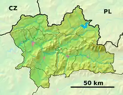 Ľubochňa Location of Ľubochňa in the Žilina Region  Ľubochňa Location of Ľubochňa in Slovakia | |
| Coordinates: 49°07′N 19°10′E / 49.12°N 19.17°E | |
| Country | |
| Region | |
| District | Ružomberok District |
| First mentioned | 1818 |
| Area | |
• Total | 113.68 km2 (43.89 sq mi) |
| Elevation | 451 m (1,480 ft) |
| Population (2021)[3] | |
• Total | 1,057 |
| Time zone | UTC+1 (CET) |
| • Summer (DST) | UTC+2 (CEST) |
| Postal code | 349 1[2] |
| Area code | +421 44[2] |
| Car plate | RK |
| Website | www |
Ľubochňa (Hungarian: Fenyőháza) is a village and municipality in Ružomberok District in the Žilina Region of northern Slovakia.
History
In historical records the village was first mentioned in 1818.
Geography
The municipality lies at an altitude of 451 metres and covers an area of 113.679 km2. It has a population of about 1042 people.
References
- ^ "Hustota obyvateľstva - obce [om7014rr_ukaz: Rozloha (Štvorcový meter)]". www.statistics.sk (in Slovak). Statistical Office of the Slovak Republic. 2022-03-31. Retrieved 2022-03-31.
- ^ a b c "Základná charakteristika". www.statistics.sk (in Slovak). Statistical Office of the Slovak Republic. 2015-04-17. Retrieved 2022-03-31.
- ^ "Počet obyvateľov podľa pohlavia - obce (ročne)". www.statistics.sk (in Slovak). Statistical Office of the Slovak Republic. 2022-03-31. Retrieved 2022-03-31.
Municipalities of Ružomberok District | ||
|---|---|---|