Île Haute
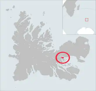 The île Haute is highlighted on this Kerguelen Islands map. | |
| Geography | |
|---|---|
| Location | Indian Ocean |
| Coordinates | 49°22′S 69°54′E / 49.367°S 69.900°E |
| Archipelago | Îles Kerguelen |
| Length | 6 km (3.7 mi)[1] |
| Width | 2 km (1.2 mi)[1] |
| Highest elevation | 321 m (1053 ft).[1] |
| Highest point | Table des Mouflons |
| Administration | |
| District | Îles Kerguelen |
| Demographics | |
| Population | 0 |
Île Haute (French pronunciation: [il ot]) is one of the Kerguelen Islands situated in the Golfe du Morbihan near the coast of Grande Terre, the principal island.
It is around 6 km long and 2 km wide. The highest point is the Table des Mouflons, at 321 metres.
References
- General view of non-metropolitan France, Maison de la Géographie.
- ^ a b c Kerguelen islands map, Géoportail IGN
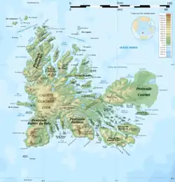
| Islands |
|  |
|---|---|---|
| Peninsulas and Presque-isles |
| |
| Mountains |
| |
| Glaciers |
| |
| Watercourses |
| |
| Principal Lakes |
| |
| Main gulfs, bays and fjords |
| |
| Locations |
| |